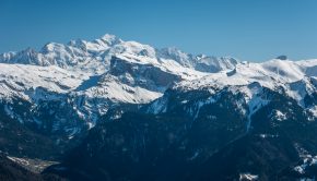
The Alps are a mountain range stretching across Europe, covering France, northern Italy, Switzerland and Germany, and are a world-renowned hiking area. The Alps, situated in the alpine-Himalayan chain and more than 1200 km long between the Mediterranean and the Danube, reach an altitude of 4810 m at the summit of Mont Blanc in the north of the mountain range. More than 80 peaks exceed 4000 m, most of which are located in Switzerland in the Valais Alps. The Alps will delight the hiker with their exceptional panoramas on a variety of breathtaking landscapes. Among the most notable regions are Haute-Savoie and its medium and high mountain ranges, the Valais and summits reaching the sky, the Val d’ Aosta and its picturesque small valleys, and much more.
Browsing the "Alps" Tag
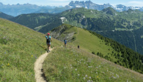
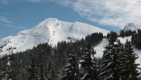
Mont de Grange
2 August 2019 | by Pierre-Alexandre
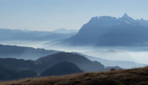
Mont de Grange is one of the iconic peaks of the Chablais Massif. At an altitude of 2432 m (which is identical to that of the Cornettes de Bise), Mont de Grange dominates the Val d'Abondance in all its splendour. The panorama offered to the hiker is undoubtedly one of the most beautiful in
Pointe d’Areu (Pointe des Arbennes)
22 July 2019 | by Pierre-Alexandre
Pointe d'Areu is a mountain overlooking the Arve valley at the end of the Aravis massif. Due to an omission on the IGN map, the Pointe d'Areu is often confused with the Pointe des Arbennes (also called Pointe d'Arbenne or Pointe d'Areu de Romme)
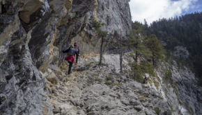
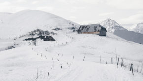
Le Pas du Roc
15 May 2019 | by Pierre-Alexandre
Le Pas du Roc is an easy walk that makes you discover the alpine meadows in the middle of the mountains by means of an unusual path on the cliff side, traced in 1830, which allowed transporting the wood intended for the ovens located in the hamlet of the " Verrerie"
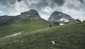
Creux-du-Van
7 May 2019 | by Pierre-Alexandre
The Creux-du-Van is a rocky cirque located in the Massif du Jura in the canton of Neuchâtel. 1.4 km wide and approximately 200 m high, the Creux-du-Van is one of the most picturesque sites in French-speaking Switzerland with its impressive walls sculpted by the erosion caused 18,000 years ago
Praz Vechin and Col de l’Arpettaz
7 January 2019 | by Pierre-Alexandre
Located in the Aravis Range, Praz Vechin is a peak overlooking the Col de l'Arpettaz nestled at the foot of Mont Charvin. The term "Arpettaz" comes from the French word "alpe" which refers to a mountain pasture. The itinerary I propose here starts from the hamlet of La Penne
La Bourgeoise and the Col de Joux Plane
3 January 2019 | by Pierre-Alexandre
Nestled in the Samoëns Valley and overlooking the Col de Joux Plane, La Bourgeoise can be the object of a short family stroll both in winter and summer. The route leads effortlessly to the top of La Bourgeoise with a beautiful panorama
Pointe de Beauregard
15 December 2018 | by Pierre-Alexandre
The Plateau de Beauregard remains the object of a beautiful winter walk in snowshoes. With an elevation gain of only 150 meters, the itinerary reaching the Pointe de Beauregard is accessible to all
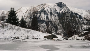
Lac d’Armancette
26 November 2018 | by Pierre-Alexandre
The Lac d’Armancette is the opportunity of a nice forest walk. The trail follows a track in a spruce forest and runs along a small stream that accompanies the hiker to the lake. Without any difficulty and very well marked, the path gets through the Contamines-Montjoie National Nature Reserve
Mont Chéry
21 November 2018 | by Pierre-Alexandre
The renowned summit of Les Gets ski resort, Mont Chéry, offers a breathtaking panorama of the Mont Blanc and the Chablais Massif. The easy itinerary starts at Mont Caly (a charming little place with
Pointe de Rovagne
3 November 2018 | by Pierre-Alexandre
Visible from the ski resort of Sommand, Pointe de Rovagne is one of these uncrowded itineraries that offer an admirable point of view on the Haute-Savoie. Very close to Haute-Pointe, facing Pointe Perret, this hike, not very well marked
Tête de Lindaret
10 October 2018 | by Pierre-Alexandre
Tête de Lindaret is a summit of the Chablais Massif, located in the south of the protected natural area of Mont de Grange. The toponym Lindaret limitaris meaning something "that makes limits or borders". Of intermediate difficulty, the itinerary I propose here describes a loop that starts from the Lindarets
Pointe de Pelluaz
25 September 2018 | by Pierre-Alexandre
Pointe de Pelluaz is a peak located in the heart of the Chablais massif, south of the Dent d'Oche. Described as peeled or bare mountain by its toponym, Pointe de Pelluaz is a beautiful hiking destination within everyone's reach. Indeed, despite a cumulative positive gain of 730 m,
Randos les plus populaires


