Hikes of the 3528ET IGN Map.
Browsing the "3528ET IGN Map" Tag
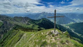
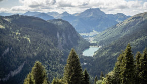
Pic de la Corne
7 June 2022 | by Pierre-Alexandre
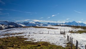
Pic de la Corne is a rather unknown summit in the Chablais massif. From the top of its 2084 m of altitude, Pic de la Corne is nevertheless an interesting hiking objective. Indeed, it offers the hiker a splendid panorama on the peaks of the Chablais
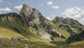
Pointe de Vernaz via Lac d’Arvouin
21 August 2019 | by Pierre-Alexandre
Pointe de Vernaz is a peak of the Chablais region, reaching an altitude of 1,993 m. The mountain overlooks Lac d’Arvouin and offers an exciting view of the surrounding peaks, such as Cornettes de Bise, Mont Chauffé or Dents du Midi. I propose a hike that reaches Pointe de Vernaz starting from
Mont de Grange
2 August 2019 | by Pierre-Alexandre
Mont de Grange is one of the iconic peaks of the Chablais Massif. At an altitude of 2432 m (which is identical to that of the Cornettes de Bise), Mont de Grange dominates the Val d'Abondance in all its splendour. The panorama offered to the hiker is undoubtedly one of the most beautiful in
Mont Chéry
21 November 2018 | by Pierre-Alexandre
The renowned summit of Les Gets ski resort, Mont Chéry, offers a breathtaking panorama of the Mont Blanc and the Chablais Massif. The easy itinerary starts at Mont Caly (a charming little place with
Tête de Lindaret
10 October 2018 | by Pierre-Alexandre
Tête de Lindaret is a summit of the Chablais Massif, located in the south of the protected natural area of Mont de Grange. The toponym Lindaret limitaris meaning something "that makes limits or borders". Of intermediate difficulty, the itinerary I propose here describes a loop that starts from the Lindarets
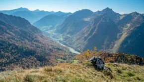
Pointe de Pelluaz
25 September 2018 | by Pierre-Alexandre
Pointe de Pelluaz is a peak located in the heart of the Chablais massif, south of the Dent d'Oche. Described as peeled or bare mountain by its toponym, Pointe de Pelluaz is a beautiful hiking destination within everyone's reach. Indeed, despite a cumulative positive gain of 730 m,
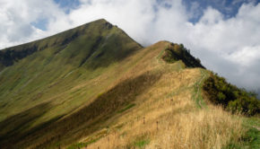
Pointe de Tréchauffé
15 October 2017 | by Pierre-Alexandre
Pointe de Tréchauffé is a summit of Chablais, which rises to 1627 m above sea level, and is the subject of a magnificent hike in the heart of the Aulps Valley. The route I propose describes a loop starting above the Chalets de Tréchauffé
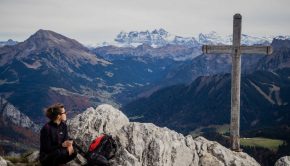
Dent d’Oche
3 September 2016 | by Pierre-Alexandre
Located in the heart of the Pays de Gavot, Dent d’Oche, overlooking Lake Geneva, offers a surprisingly rich hiking objective. During the ascent, the trail through the alpine pastures changes rapidly as it goes up amidst rocks from the refuge
Pointe d’Uble
27 December 2015 | by Pierre-Alexandre
The view from Pointe d’Uble highlights the mountains that surround it thanks to its location in the heart of Chablais. All the Massifs of Haute-Savoie are exhibited in the eyes of the hiker whose memory will remain marked by the multitude of peak
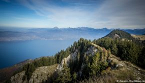
Balcon des Mémises
25 October 2015 | by Pierre-Alexandre
The Balcon des Mémises is the object of a magnificent hike alternating between paths in the forest, easy climbing in big blocks of rocks, and walking along the crests with a beautiful panorama on Lake Geneva, Chablais, and Jura Massif
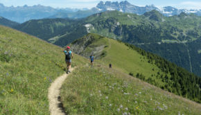
Mont Ouzon
24 October 2015 | by Pierre-Alexandre
Mont Ouzon and its rocks remain a very beautiful point of view on the Chablais Alps and the Mont Blanc Massif as well as on Lake Geneva. The climb is quite harsh at first in the forest but gets smoother when reaching the Col de Planchamp
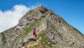
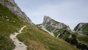
Hauts-Forts
2 August 2015 | by Pierre-Alexandre
Dominating the ski resort of Avoriaz located at the southern end of the Chablais, Hauts-Forts is an ideal goal where one strolls into a desert environment after the winter bustle. The impression created by the scene is part of a double contrast
12


