Hikes of the 3430ET IGN Map.
Browsing the "3430ET IGN Map" Tag
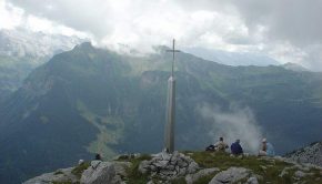
Pointe de Deux Heures
23 August 2009 | by Pierre-Alexandre
Pointe de Deux Heures (whose name refers to the climbing time) is one of the most unknown summits of Haute-Savoie. Indeed, the absence of signage makes this walk somewhat wild, especially given the low number of hikers encountered on the track
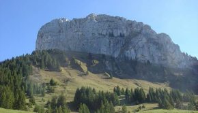
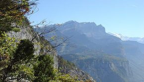
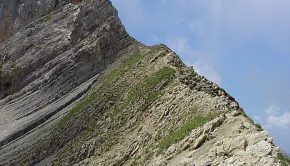
Roche Parnal
1 October 2008 | by Pierre-Alexandre
Overlooking the Bornes Massif, Roche Parnal presents itself as a large rocky boulder between Montagne de Sous-Dine and the Trampes. Once at the top of Roche Parnal, you will discover a magnificent panorama
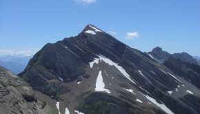
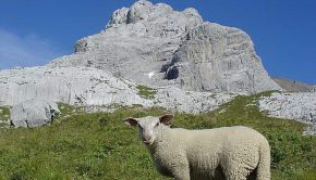
Tête Pelouse
26 July 2008 | by Pierre-Alexandre
Tête Pelouse is the object of a superb hike that will make you discover the Aravis Range and the beautiful Valley of Confins. Not so far from the Lac and Pointe de Tardevant, the itinerary reaches a rocky summit not very frequented that offers an unforgettable point of view
Tour des Rochers de Leschaux
3 August 2007 | by Pierre-Alexandre
The Tour des Rochers de Leschaux is part of the excursions demanding little effort, but which still require a good physical condition considering the length of the itinerary, as well as a secure foot to get through several steep passages with high declivity (but no exposed passages). The Rochers de Leschaux
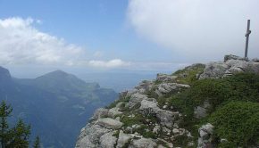
Petit Bargy
29 July 2007 | by Pierre-Alexandre
The panorama discovered at the top of the Petit Bargy will enchant hikers wishing to contemplate the greater part of the Aravis Range. Made of limestone, the imposing Bargy Massif is ideally located for a discovery of the Aravis. In addition, many ibexes have settled on the
Montagne de Chevran
11 October 2005 | by Pierre-Alexandre
I propose here a small walk above Cluses. The Montagne de Chevran offers a spectacular view over the Valley of the Arve, Pointe d’Areu, the Môle, Pointe d’Andey, and many other summits
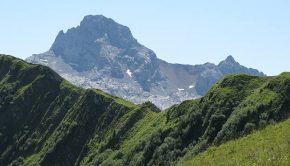
Pointe Percée and Col des Verts
20 August 2005 | by Pierre-Alexandre
I propose here two itineraries in one: Pointe Percée and the Col des Verts. The ascent of Pointe Percée is definitely not made for families. The last third of the route after the ascent of a fairly steep scree requires the use of the hands to rise in faults and chimneys on slippery rocks
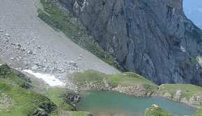
Pointe et Lac de Tardevant
18 July 2005 | by Pierre-Alexandre
The Aravis Range is made up of a succession of combes delimited by calcareous peaks. The combe of Tardevant is situated in middle and is the only one to have a lake, which makes it a perfect hiking destination. The itinerary runs along the slopes of the Grand Crêt
Pic du Jallouvre
15 July 2005 | by Pierre-Alexandre
Pic du Jallouvre remains a very beautiful excursion reserved for the experienced walkers. If the beginning of the trail is a charming bucolic walk in the alpine pastures of Cenise, what follows next is quite different: very quickly, the path passes near a vast scree
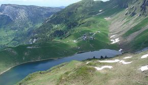
Lac de Lessy
6 June 2005 | by Pierre-Alexandre
The Lac de Lessy is nestled in a valley at the foot of the Jallouvre, the Buclon, and Aiguille Verte. The route proposed from the Chinaillon is intended for good walkers; It takes a route that goes through Aiguille Verte before going down to the Lac de Lessy. In the first part of the trail, signs inform
12
Randos les plus populaires


