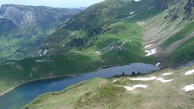
Lac de Lessy
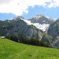
The Lac de Lessy is nestled in a valley at the foot of the Jallouvre, the Buclon, and Aiguille Verte. The route proposed from the Chinaillon is intended for good walkers; It takes a path that goes through Aiguille Verte before going down to the Lac de Lessy. In the first part of the trail, signs inform about the nature of the terrain in which you hike, the surrounding peaks, the fauna, and the flora of the region.
The viewpoint at the top of the ridge is magnificent over the Aravis Range, Lake Geneva, and Lac de Lessy.
I also propose another alternative which, this time, passes through the Petit-Bornand.
- Difficulty: Intermediate
- Altitude: 1,781 m at the Lac de Lessy, 2,045 m at Aiguille Verte
- Ascent: 2 hours 00 min to get to Aiguille Verte + 0 hour 20 min to get to the Lac de Lessy
- Descent: 1 hour 00 min + 0 hour 30 min to climb up the ridge from the lake
- Elevation Gain: 670 meters
- Round-trip: 8.6 km
- Map: <b>IGN 3430 ET</b>
Getting There
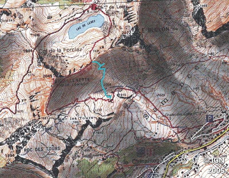
Take the A40 motorway towards Chamonix and leave it at Bonneville. Follow signs for La Clusaz (D12 road). After Entremont, just before a bridge, turn left towards the Grand-Bornand by the Villaret. At Grand-Bornand, continue towards Col de la Colombiere. Go through the Chinaillon and take the path on the left in the direction of the alpine pastures of Samance. Park on the roadside in front of the chalet (signpost).
GPS Coordinates (WGS 84) of the Starting Point: 45.974562, 6.453521
Ascent
Follow the signs and take the path that leads to the right of the road. After about ten minutes, leave the track to take a footpath on the right, which reaches the cottage farm. After crossing the alpine pastures, the path turns left and becomes steeper.
A small pathway on the left (traced in blue on the IGN map) allows to arrive directly at the ridge between the Buclon and Aiguille Verte: I advise against it in wet weather, because the last part is very steep and exposed.
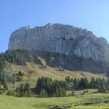
The ascent gets steeper again until reaching a small pass. Leave the Roc des Tours on the left and follow the path leading to Aiguille Verte.
Once arrived on the ridge, a pathway leads to the top of Aiguille Verte: leave it on the left and continue along the ridge (without risk) until the fork that goes down to the Lac de Lessy. Go down into the valley to reach the lake and the Chalets de Lessy.
Descent
Go up (yes!) to the pass and take the same route. The bravest will surely make a short detour to climb the top of Aiguille Verte. Be careful during the final ascent since the top is made up of two small peaks: the first is safe, but the second is dangerous as you need to cross an exposed passage. I strongly advise against hikers who are afraid of heights.
Photos of the Lac de Lessy (via the Chinaillon)


Route
Download the route (KML) Download the route (GPX)
This post is also available in Français
About the Author
Pierre-Alexandre 33 ans, fondateur et webmaster de Randos-MontBlanc. Suivez-moi sur @pierrealexphotography


