Petit Bargy
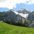
The panorama discovered at the top of the Petit Bargy will enchant hikers wishing to contemplate the greater part of the Aravis Range.
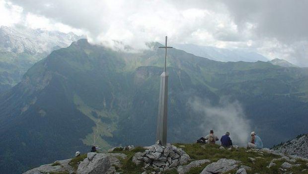
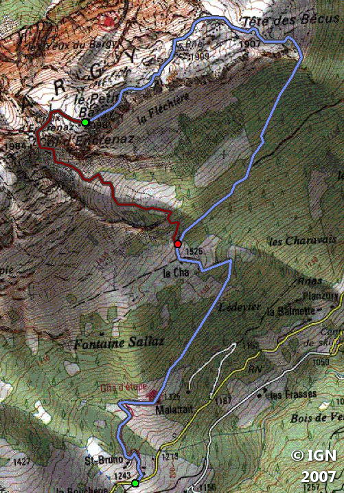
Made of limestone, the imposing Bargy Massif is ideally located for a discovery of the Aravis. Also, many ibexes have settled on the steep slopes of the Bargy, and it is very common to meet them behind a rock. The itinerary describes a loop that climbs from the mountain pastures of Malatrait to a forest before getting through a very steep scree, followed by a passage in the lapiaz of the Tête des Bécus to reach the summit of Petit Bargy. The summit is not indicated by signs: only an IGN marker at its top materializes its existence.
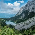
The descent goes through the Col de l’Encrenaz that overlooks Lac Bénit. An exposed passage requires sustained attention; The use of a cord for children can be useful. The route is ranked average not by the requested effort that is very reasonable, but due to several delicate passages, notably the short scree during the ascent, and especially the Col de l’Encrennaz that can prove to be dangerous and block people who are afraid of heights.
- Difficulty: Intermediate
- Altitude: 2,098 m at the top of Petit Bargy
- Ascent: 2 hours 00 min
- Descent: 1 hour 30 min
- Elevation Gain: 850 meters
- Round-trip: 8.4 km
- Map: <b>IGN 3430 ET</b>
Getting There
From Scionzier, get to the Reposoir. After Le Reposoir, in St-Bruno, take the road on the right that leads to a small car park about 300 meters away.
GPS Coordinates (WGS 84) of the Starting Point : 46.008849, 6.514502
Ascent
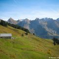
Reach the Chalet de Malatrait and Chalet de La Cha by the forest track. Go past the last chalet and, at the junction, leave on the left the trail leading to the Encrennaz (which will be taken for the return journey) to head towards La Forclaz.
Keep moving on the footpath in the wood and leave on the left the pathway leading to the cave. After a steep crossing, a sign invites to turn left towards Tête des Bécus.
The path becomes much more abrupt and rises quickly to a very steep scree that can be delicate in wet weather. Continue the itinerary marked by colored marks painted on the rocks, and turn to the left to reach a passage between big stones.
Follow the direction “Encrenaz” until Tête des Bécus. A rather discrete IGN geographic marker indicates the altitude. Proceed in the lapiaz to win Petit Bargy materialized by the cross.
Descent
From the summit, move in front of Grand Bargy and descend by the trail that runs down to the Col de l’Encrennaz very quickly gained by some steep switchbacks.
The passage of the Col de l’Encrenaz is delicate at the very beginning, and one must not hesitate to use hands in this exposed passage; A cord for children may be necessary. Continue the few switchbacks in the gravel path that goes down into the alpine pastures. On the left, the track leads to the cave and then descends to the Cha.
Keep moving and take the pathway of the ascent.
Photos of Petit Bargy


Route
Download the route (KML) Download the route (GPX)
This post is also available in Français
About the Author
Pierre-Alexandre 33 ans, fondateur et webmaster de Randos-MontBlanc. Suivez-moi sur @pierrealexphotography


