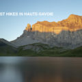
What are the Best Hikes around Geneva?
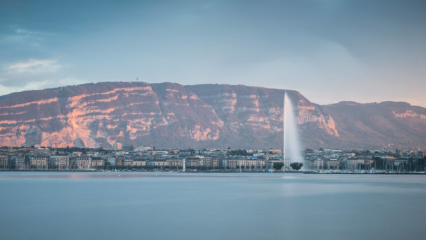
You live in Geneva or you are only visiting for a few days and you want to go hiking? The summits surrounding the town of Calvin offer magnificent panoramic views of Lake Geneva, the Jura and many of the peaks of Haute-Savoie. In this article, I describe the hiking routes that, in my opinion, are must-see around Geneva. These hikes are accessible to all and do not present any particular technical difficulties. I want to point out that almost all the departure points for the trips described below can be reached by public transport.
Here are the hikes that, from my point of view, are worth a visit around Geneva:
Salève
Let’s start this list with a great classic of the Lake Geneva region: the Salève. Also known as the “balcony of Geneva”, Salève is a land of leisure par excellence as it is a place for hiking, climbing, paragliding, mountain biking and many other activities! Even if it is possible to climb to Le Salève with the cable car built in 1932, reaching the summit on foot from the plain is a pleasant experience!
Many trails are available to the hiker: the Orjobet trail starting in the hamlet of Le Coin is a first possibility. However, this includes cable and exposed passages that can discourage people with a fear of heights. The route from Pas de l’Echelle is probably the best known since it is accessible by bus 5 of the TPG. This route does not have any exposed passages. It joins Monnetier and then climbs towards the cable car. However, my favourite itinerary starts in Etrembières and reaches Le Petit Salève first before going down to Monnetier and continue towards the cable car. Whatever the route taken, a good physical level is required, as the climb is quite steep.
For the Etrembières trail:
Difficulty: Hard ![]()
Altitude: 1,277 m
Ascent: 2 hours 40 min
Descent: 1 hour 50 min
Elevation Gain: 1030 meters
Round-trip: 15.8 km
La Dôle
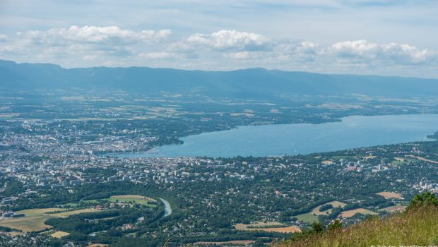
La Dôle is an iconic peak in the Lake Geneva basin that can be easily recognized with its large white “ball”. In fact, this strange facility contains a weather station and an aviation radar. La Dôle is a prime observation point over the entire Mont-Blanc chain and a large part of the Chablais mountains. The hike I propose is a loop that starts from St-Cergue station and follows the SuisseMobile route n° 5 “Chemin des Crêtes du Jura”.
This loop reveals the magnificent landscapes of the plains typical of the Jura region. However, I would like to point out that a certain physical level is required since the route is almost 16 km long in total. It is possible to do the route in one direction (St-Cergue – Col de Porte – La Dôle – La Barillette) or in the other (St-Cergue – La Barillette – La Dôle – Col de Porte), but I prefer the first option because the approach walk to the summit is much more pleasant.
Difficulty: Intermediate ![]()
Altitude: 1,677 m
Ascent: 2 hours 10 min
Descent: 1 hour 50 min
Elevation Gain: 700 meters
Round-trip: 15.9 km
Crêt de la Neige and Reculet
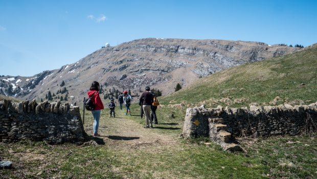
With an altitude of 1719 and 1718 m respectively, Crêt de la Neige and Reculet are the two highest peaks in the Jura. Despite the appearance of peaceful green hills, they require a significant effort on the part of the hiker. Indeed, the ascent is long and includes many steep passages. The route I suggest presents an itinerary winning the two summits and a route that only climbs the Reculet. Whatever the path chosen, good physical training is required.
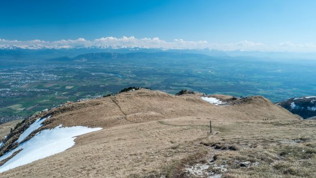
Once you arrive at Crêt de la Neige or Reculet, you can only be amazed by the beauty of the landscape. Like La Dôle, the view extends from the peaks of the Chablais and Giffre to those of the Massif du Mont-Blanc. For walkers using public transport, take the TPG Y bus and get off at the “Thoiry, mairie” stop and follow the direction of Tiocan to reach the departure car park.
Difficulty: Hard ![]()
Altitude: 1,720 m
Route (Crêt de la Neige + Reculet): 5 hours 15 min
Ascent (Reculet only): 2 hours 30 min
Descent (Reculet only): 1 hour 30 min
Elevation Gain (Crêt de la Neige + Reculet): 1400 meters
Elevation Gain (Reculet only): 1290 meters
Round-trip (Crêt de la Neige + Reculet): 14.0 km
Round-trip (Reculet only): 13.1 km
Signal des Voirons
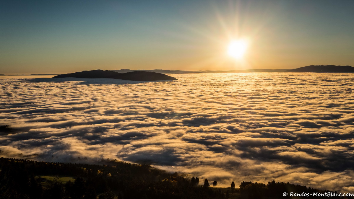
Located east of Geneva, the Voirons Mountain is a classic that I recommend to all those wishing to get started in hiking. As a matter of fact, the effort required to reach the Signal des Voirons is almost nil, and the view offered from it is one of the most beautiful in the Lake Geneva basin. In winter, when the sea of clouds covers the valley, the landscape changes completely! I advise you to start from the parking lot of the monastery of Bethlehem to climb to the Signal des Voirons and then continue on the mountain of Voirons to reach the Pointe de Brantaz.
Unlike the outings described above, it is unfortunately not possible to reach the starting point by public transport. If you do not have a car, you can use, for example, a car-sharing service such as Mobility.
Difficulty: Very Easy ![]()
Altitude: 1,480 m at the Signal des Voirons, 1,457 m at Pointe de Brantaz
Route: 1 hour 45 min
Elevation Gain: 230 meters
Round-trip: 4.6 km
This post is also available in Français
About the Author
Pierre-Alexandre 33 ans, fondateur et webmaster de Randos-MontBlanc. Suivez-moi sur @pierrealexphotography