Hikes of the 3429ET IGN Map.
Browsing the "3429ET IGN Map" Tag
Pointe de Miribel
7 November 2015 | by Pierre-Alexandre
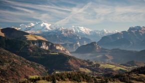
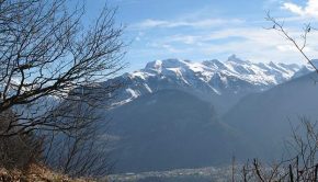
Located in the Vallée Verte, in the heart of Chablais Massif, Pointe de Miribel remains an ideal objective for the beginner or for training at the beginning of the season. Very easy to reach, the summit offers a magnificent panorama on alpine pastures and peaks
Signal des Voirons
31 October 2015 | by Pierre-Alexandre
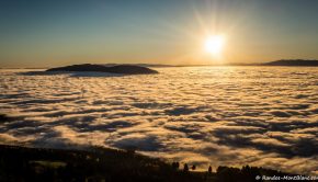
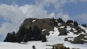
The Signal des Voirons offers a very accessible walk even for youngsters, allowing to discover along the way a magnificent panorama on Lake Geneva and the Jura Massif on one side as well as Mont Blanc and Chablais
Pic du Marcelly
12 September 2012 | by Pierre-Alexandre
Pic du Marcelly is the object of a magnificent hike that describes a loop starting through the pastures of Praz-de-Lys, to continue on the ridges of Pointe de la Couenasse, before ending overlooking Lac de Roy. Formerly classified as “difficult” because
Col de Cordon
12 January 2012 | by Pierre-Alexandre
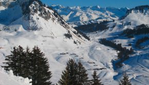
From the ski resort of Sommand, many summer hikes are possible in winter. For a discovery of the snowshoe outing, I propose the Col de Cordon that is an easy and safe route. The elevation gain of 230 m is climbed in about one hour depending on the snow conditions
Mont Orchez
5 March 2008 | by Pierre-Alexandre
With Montagne de Chevran, Mont Orchez constitutes a superb belvedere on the Valley of the Arve facing the Môle and the Bargy Massif. Without any difficulty, the path gets through a beautiful forest by a sometimes very steep path. In wet weather, the descent can be very slippery
Sur la Pointe (or Rochers de la Motte)
19 April 2007 | by Pierre-Alexandre
Situated opposite Pointe de la Gay, this summit named Sur la Pointe is a hiking destination within easy reach of everyone, and is ideal for a nice family outing. The summit of Sur la Pointe offers a beautiful panorama of Lake Geneva, the Roc d'Enfer and the pastures of Chablais, and overlooks
Pont du Diable (Mieussy)
20 August 2006 | by Pierre-Alexandre
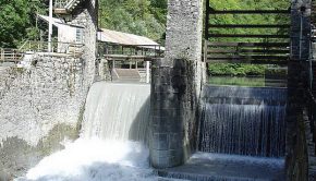
The Pont du Diable is a nice little walk near Mieussy as it allows discovering the Giffre in a small valley. Under the bridge, the Gorge du Giffre is four meters wide, nine meters deep. It is the ideal ground for the practice of canyoning, kayaking, or sport fishing. The hydroelectric dam, operated by
Pointe de la Gay
16 May 2005 | by Pierre-Alexandre
Being the highest peak of a massif of average altitude, Pointe de la Gay dominates a vast plateau and discovers a 360 ° panorama on Lake Geneva including Roc d'Enfer, Cornettes de Bise, and Pointe de Chalune among others. The itinerary describes a loop using paths, starting with the paved road at
12
Randos les plus populaires


