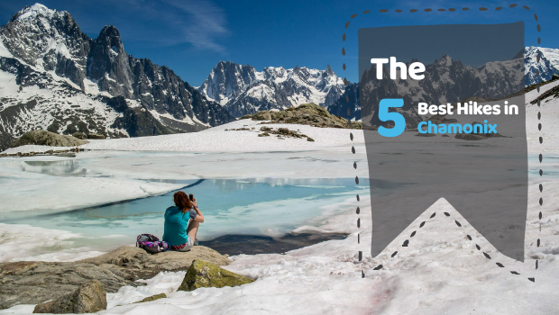
The 5 Best Hikes in Chamonix
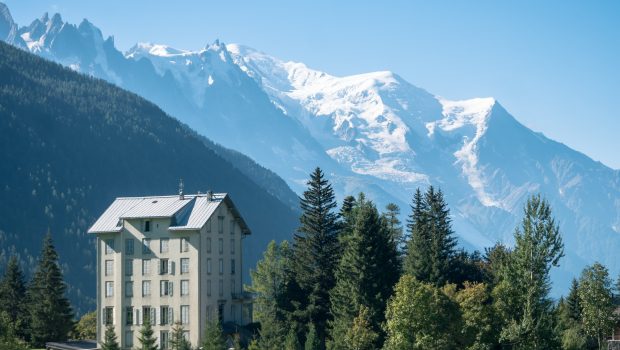
Ah, Chamonix… the simple evocation of the name of the most famous city in the Alps awakens in each of us a palette of varied representations. The Olympic Games, skiing, hiking, Mont Blanc, mountaineering, climbing… It’s not really my habit to publish blog articles, but I thought that a small change of editorial line couldn’t hurt. On the contrary, for the hiker who is visiting Chamonix Valley for a few days, it can be difficult to know which mountains to climb… there are so many treasures to discover!
In this article, you will find the five hikes in the Chamonix valley, which I believe are must-see. If you are only in the area for a few days, I strongly advise you to do these itineraries. You will be enchanted not only by the splendour of the landscapes you encounter, but also by the incredible biodiversity of the sites you will see.
Without further ado, here are the five hikes I recommend:
Lac Blanc (via the Col des Montets or Tré-le-Champ)
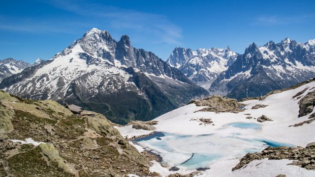
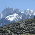
Without hesitation, Lac Blanc comes first in my list of recommendations. Admittedly, the site is very popular during the high season, but the quality of the landscapes offered to the walker is probably beyond compare! Nestled in the heart of the Aiguilles Rouges Nature Reserve, Lac Blanc is a lake located at an altitude of 2352 m.
It consists of a lower part with a depth of about three metres and an upper part with a depth of about ten metres. The waters of Lac Blanc flow into a stream joining the Arve below at the place called “Les Îles” north of Chamonix. Usually, the back part of the lake remained snow-covered until late in the summer (mid-August), but with global warming, the melting of ice and snow on the back part occurs earlier and earlier (late June, early July).
The panorama served to the hiker once arrived at Lac Blanc is simply astounding. The peaks of the Mont-Blanc Massif seem within reach! There are two possible routes to reach the lake: from La Flégère, or from the Col des Montets or Tré-le-Champ. The route through the Flégère uses the eponymous cable car to reach Lac Blanc in less than two hours. In my opinion, it is preferable to opt for the variant starting from the Col des Montets or Tré-le-Champ. Indeed, these two routes are much wilder and less frequented than the Flégère route.
Difficulty: Hard ![]()
Altitude: 2,352 m
Ascent: 2 hours 45 min for both routes
Descent: 1 hour 30 min via Tré-le-Champ’s path / 2 hours 00 min via the Col des Montets’s path
Elevation Gain: 990 meters via Tré-le-Champ’s path / 970 m via the Col des Montets’s path
Round-trip: 8.0 km via Tré-le-Champ’s path / 9.4 km via the Col des Montets’s path
Restrictions : Dogs (even on a leash) and gathering prohibited. Bivouac allowed between 7 pm and 9 am.
Aiguillette des Houches
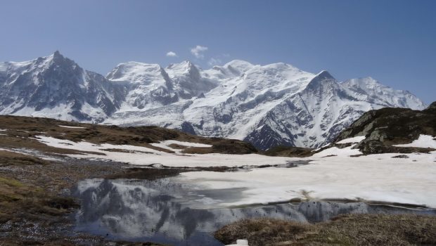
Much less popular than Lac Blanc, Aiguillette des Houches is a summit that I regularly recommend without hesitation. Located in the Carlaveyron Nature Reserve, Aiguillette des Houches rises to an altitude of 2285 m and dominates the eponymous village below. This peak actually marks the western limit of the Massif des Aiguilles Rouges and remains a magnificent viewpoint on the Massif du Mont-Blanc, but also the Massif des Fiz to the north. In addition to the exceptional panorama, the site is a treasure of biodiversity: indeed, the meadows of Carlaveyron are punctuated by small refuge ponds for many species.
The route to reach the Aiguillette des Houches starts at the parking lot of Parc de Merlet (which I strongly invite you to visit after the hike) located south of Chamonix. The route follows a loop that first connects the Refuge de Bellachat, then the summit, before descending again through the Chalets de Chailloux to reach the car park.
Difficulty: Intermediate ![]()
Altitude: 2,285 m
Ascent: 3 hours 15 min
Descent: 1 hour 45 min
Elevation Gain: 910 meters
Round-trip: 9,1 km
Restrictions : Dogs (even on a leash) and gathering prohibited. Bivouac allowed between 7 pm and 9 am.
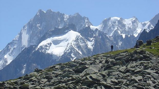
Lac Cornu and Lacs Noirs
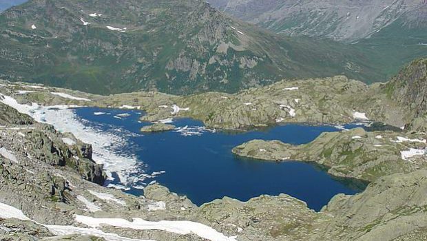
Another classic of the Massif des Aiguilles Rouges: Lac Cornu and Lacs Noirs. Of glacial origin, Lac Cornu is a natural lake culminating at an altitude of 2276 m. The lake has an area of 54.4 ha and a maximum depth of 22 m. Its volume is approximately of 550,000 m3. The waters of the lake flow into the Torrent du Lac Cornu to reach the Diosaz below. Higher up, we find Lacs Noirs composed of two parts whose waters flow into the torrent of the same name at first, then into the Petit Lac a little lower and finally into the Diosaz at a later stage.
As usual in the Aiguilles Rouges, Lac Cornu and the Lacs Noirs offer magnificent views of the Mont-Blanc Massif. The site is much less frequented than that of Lac Blanc. They are therefore a great idea for hiking if you are afraid of the crowd. The itinerary I propose starts from Planpraz station (arrival of the cable car that goes up from Chamonix) and then climbs to the Col du Lac Cornu and then the Col de la Glière to finally reach the Lacs Noirs.
Difficulty: Intermediate ![]()
Altitude: 2,276 m at the Lac Cornu, 2,540 m at the Lacs Noirs
Ascent: 1 hour 45 min to get to the Lac Cornu, 2 hours 30 min to get to the Lacs Noirs
Descent: 1 hour 30 min from the Lacs Noirs
Elevation Gain: 790 meters
Round-trip: 11.0 km
Restrictions : Dogs (even on a leash) and gathering prohibited. Bivouac allowed between 7 p.m. and 9 a.m.
Montagne de Peclerey
This time we go east of the Chamonix valley to climb one of the least known mountains in the area: the Montagne de Peclerey. Located above the village of Argentière, this mountain will delight hikers looking for calm and serenity. In fact, there are not many people on its trails, and the landscapes encountered are quite wild. The most significant parts of the itinerary remain undoubtedly the ascent along the moraine of the Glacier du Tour as well as the plateau at the top offering a magnificent view of both Mont Blanc and the Aiguilles Rouges.
The hike starts from the Planet car park and follows a loop to the Tour before climbing the Montagne du Peclerey and then descending through the forest of the Grand Chantet. In my opinion, this is the perfect route to get started in hiking!
Difficulty: Intermediate ![]()
Altitude: 1,967 m at the Tête du Grand Chantet
Ascent: 1 hour 50 min
Descent: 1 hour 20 min
Elevation Gain: 630 meters
Round-trip: 6.7 km
The Balcon Nord
To finish this list of recommendations, I propose a “monster” of the Chamonix valley: the Balcon Nord. This hike is a classic of the valley. It first introduces the hiker to the Mer de Glace. Then, it evolves at the foot of the Aiguilles de Chamonix along a mythical path. I use the term “monster” when referring to the Balcon Nord, since the physical effort required to complete the entire walking route is demanding. 1550 m of cumulative gain in altitude, 16.4 km for a total climb of 5 hours and a half !
If you choose the entire route on foot, the descent to Chamonix from the Plan de l’Aiguille is challenging with its many curves and steep passages. Fortunately, it is possible to shorten the itinerary by taking the Montenvers train to reach the Mer de Glace. At the end, you can then take the Aiguille du Midi cable car to go down into the valley.
The Balcon Nord remains a beautiful conclusion that will certainly make you want to conquer ever higher peaks!
Difficulty: Very Hard without taking any cable car or cog railway ![]()
Hard if you take the cable car of cog railway for the ascent ![]()
Intermediate if you take the cable car and cog railway for the ascent and the descent ![]()
Altitude: 2,198 m at the Signal de Forbes, 2,299 m at the Lac Bleu
Ascent: 2 hours 30 min via the Montenvers path + 1 hour 00 min to get to the Signal de Forbes + 2 hours 00 min to walk along the Balcon Nord = 5 hours 30 min in total
Descent: 2 hours 30 min from the Lac Bleu
Elevation Gain: 1,550 meters in total
Round-trip: 16.4 km
This post is also available in Français
About the Author
Pierre-Alexandre 33 ans, fondateur et webmaster de Randos-MontBlanc. Suivez-moi sur @pierrealexphotography


Salut! Thank you for putting together this list. I’m planning on visiting soon, and was planning to just use public transportation. Do you think it will be feasible especially getting to hikes 1,2 & 5 via bus? Also do you have any recommendations for a 2 day 1 night backpacking (not sure if that’s allowed).
Merci!
Hi! Yes, you can definitely use public transport to get to the starting point of the hikes 1,2 and 5. For hike 1, use line 21 and stop at “Col des Montets” : https://www.montblancbus.com/media/upload/Chamonix/Estivales/2020/chamonix_bus_horaires_ligne_21.pdf For hike 2, use line 1 and stop at “Les Houches, Mairie” : https://www.montblancbus.com/media/upload/Chamonix/Estivales/2020/chamonix_bus_horaires_ligne_1.pdf And for hike 5, also use line 1 and stop at “Chamonix Sud” or “Chamonix Centre”. Bivouacking is allowed between 7 pm and 9 am. I’d suggest you go for it on your hike to Aiguillette des Houches. You can set up your tent right before the Carlaveyron Plain, you’ll have a… Read more »
Thank you for the detailed response!