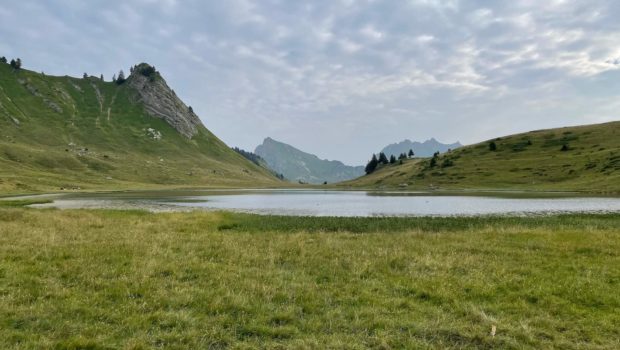
Lac de Roy
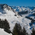
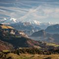
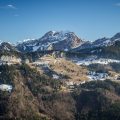
Lac de Roy is a typically family-friendly walk in the heart of the Chablais massif, taking in the Sommand and Praz-de-Lys mountain pastures. Starting from the Col de la Ramaz, this walk is very easy as it is short and almost flat. It will therefore appeal to children of all ages.
Lac de Roy is the starting point for a number of hikes, including Pic de Marcelly, easily recognisable by the cross on its summit, Pointe de Perret (1941 m) and Pointe de Haut Fleury (1981 m). Although Lac de Roy is not part of the Roc d’Enfer nature reserve (unlike Pointe de Chalune, for example), dogs must be kept on a lead.
- Difficulty: Very Easy
- Altitude: 1,661 m
- Ascent: 0 hour 30 min
- Descent: 0 hour 25 min
- Elevation Gain: 130 meters
- Round-trip: 3.8 km
- Map: IGN 3429 ET
- Restrictions: Bivouac and fires strictly forbidden between June and October. Dogs must be kept on a lead
Getting There
From Le Praz-de-Lys or Sommand, continue on the D308 towards the Col de la Ramaz. The car park is on the left (when coming from Sommand) or right (when coming from Le Praz-de-Lys) of the road, beside the small artificial lake.
GPS Coordinates (WGS 84) of the Starting Point: 46.159389, 6.580568
Ascent
From the car park, take the well-marked path to the west of the D308, which leads easily to the Chalet de Véran. Once past the chalet, continue along the path towards Lac de Roy, which takes around fifteen minutes to reach.
The more courageous can continue along the path to the right of the lake towards Pointe de Perret. The ascent is steep and requires a sustained effort of around thirty minutes. However, the effort will be well rewarded by the panoramic view from the top of Pointe de Perret.
Descent
Take the same route as depicted above.
Photos of the Lac de Roy
")
")
")
")
")
")
")
")
")
")
")
")
")
")
")
")
")
")
")
")
")
")
")
")
")
Route
Download the route (KML) Download the route (GPX)
This post is also available in Français
About the Author
Pierre-Alexandre 33 ans, fondateur et webmaster de Randos-MontBlanc. Suivez-moi sur @pierrealexphotography