Croix de la Frête
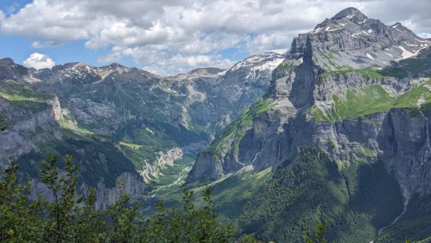
Croix de la Frête is a summit (actually, a shoulder of Montagne de Commune) in the Haut-Giffre massif. Although it is much less well-known than Mont Buet or Cheval Blanc, which are situated further up the mountain, Croix de la Frête is still an interesting itinerary because of the panoramic views offered along the way. From Croix de la Frête you can see the magnificent Cirque du Fer à Cheval to the north-east and the imposing Pic de Tenneverge.
The hike is classed as difficult due to the length of the route and the fact that the descent on the passable track is not easy in places.
- Difficulty: Hard
- Altitude: 1,969 m
- Ascent: 3 hours 00 min
- Descent: 2 hours 00 min
- Elevation Gain: 870 meters
- Round-trip: 12.0 km
- Map: IGN 3530 ET
- Restrictions: Dogs and gathering prohibited. Bivouac allowed between 7 p.m and 9 a.m.
Getting There
Go to Sixt-Fer-à-Cheval and cross the bridge to take the D29 towards Salvagny. Continue for around 1 km and turn left onto the small road towards Le Planay. Continue as far as the hamlet of Passy, which is the end of the tarmac road. Park near the hamlet, bearing in mind that parking spaces are scarce. Note, however, that you can park after the last houses; a short but steep climb takes you to a flat area with a wide open space at the entrance to the forest.
GPS Coordinates (WGS 84) of the Starting Point: 46.048114, 6.780088
Ascent
Take the track through the forest to the Croix des Vagnys (1334 m). Then, at the signpost, turn right onto the path heading towards Croix de la Frête. Continue along the track (which is quite steep in places) to the Chalets de Commune. The climb is mostly in the shade until you reach a large flat area where you can see the pasture of Commune and, in the distance, the chalets of Praz de Commune, which you need to reach. There are two small streams of varying flow that need to be crossed. These are not difficult to cross, however, as there are stones to help you. This large flat area allows you to recover from the effort of the fairly long trail.
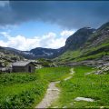
You then reach the Praz de Commune chalets. From here, the path is no longer signposted, but is still easy to follow thanks to the small cairns. The path rises up the slope in short twists and turns and becomes better marked as it climbs. The gradient is much steeper near the finish, marked by the large metal cross emerging from the vegetation. The view from the summit is splendid, taking in the waterfalls of the famous Cirque du Fer à Cheval and the nearby Pic du Tenneverge.
Descent
Follow the same route as described above.
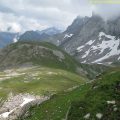
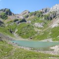
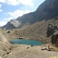
Photos of Croix de la Frête
")
")
")
")
\" (8 juillet 2023)")
")
")
")
")
")
")
")
")
")
")
")
 (8 juillet 2023)")
")
")
")
")
")
")
")
")
")
")
Route
Download the route (KML) Download the route (GPX)
This post is also available in Français
About the Author
Pierre-Alexandre 33 ans, fondateur et webmaster de Randos-MontBlanc. Suivez-moi sur @pierrealexphotography


Thanks for a very nice route! We hiked it today (11 May 2024) and the path was almost fully snow-free.
Thank you for letting us know 🙂