Chalets de Sales, Col de la Portette, and Dérochoir
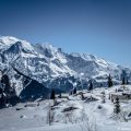
Situated in the heart of the Fiz massif, between the Désert de Platé to the west and the Rocher des Fiz overlooking Lac d’Anterne to the east, the Chalets de Sales on the Grand Pré plain are a small haven of peace that will delight walkers. Although the first part of the route is quite steep, the scenery will soon make you forget the effort you have put in on the GR 96, which alternates between rivers and waterfalls.
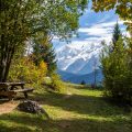
The route described here is a loop that leads to the Chalets de Sales, then to the Col de la Portette at the southern end of the Désert de Platé, before returning to the Passage du Dérochoir to begin the long descent to the Lignon. There are no particular difficulties, apart from the length of the route (around 18km), which may intimidate beginners.
- Difficulty: Hard
- Altitude: 1,877 m at the Chalets de Sales ; 2,354 m at the Col de la Portette ; 2,220 m at the Dérochoir
- Route: 2 hours 00 min to get to the chalets (5 hours 30 min in total)
- Elevation Gain: 700 meters to get to the chalets ; 1,330 m in total
- Round-trip: 17.6 km in total
- Map: IGN 3530 ET
- Restrictions : Dogs (even on a leash) and gathering prohibited. Bivouac allowed between 7 pm and 9 am.
Getting There
From Samoëns, head for Sixt-Fer-à-Cheval and turn right over a small bridge towards the Lignon and the Cascade du Rouget. Park at the end of the road near the chalet-restaurant.
GPS Coordinates (WGS 84) of the Starting Point: 46.021014, 6.768419
Route Description
From the Le Lignon car park, follow the sign “Passage du Dérochoir – 3 h 10”. The path then enters the forest. A little further on, the path leads to the beautiful waterfalls of La Pleureuse and La Sauffaz. Leave the path on the left towards Lac d’Anterne and turn right towards the path marked “Col de la Portette (GR 96) – 2h 45”.
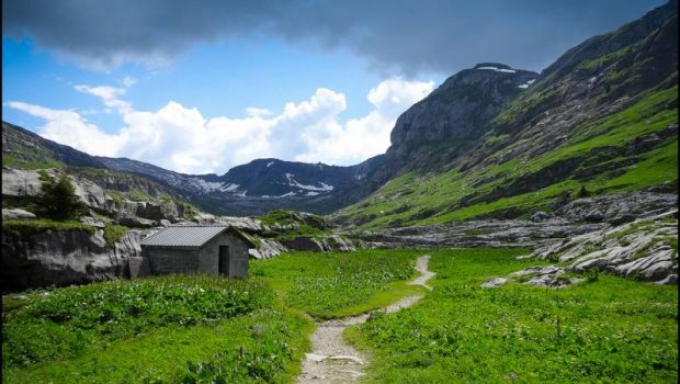
After a few steep hairpin bends, you reach the Torrent de Sales on a path that flattens out. Continue either on the footbridge to the right or on the path to the left to reach the gorges and the Sales waterfall. A series of short, sharp bends leads to the Trainant waterfall further upstream, before arriving at the refuge and the Chalets de Sales, just a few minutes away.
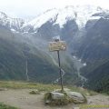
Continue on to reach the heart of the Grand Pré plain. At a signpost, turn right towards “Col de la Portette – 1h 45”. The route leads over large boulders and through grass on a path that soon reaches the Désert de Platé and the small lakes of Les Laouchets on the right. After a short final effort, you reach the Col de la Portette.
From here, turn right towards the Passage du Dérochoir, as indicated by the sign at the foot of the pass. The path crosses several scree slopes below the Pointe de Platé and the Pointe du Dérochoir. You will then reach the Passage du Dérochoir, where you will be rewarded with a magnificent view of the Mont Blanc massif.
Return to the path and go straight down towards Grand Pré to return to the Le Lignon car park.
Photos of the Chalets de Sales, the Col de la Portette, and the Dérochoir
")
")
")
")
")
")
")
")
")
")
")
")
")
")
")
")
")
")
")
")
")
")
")
")
")
")
")
")
")
")
")
")
")
")
")
")
")
")
")
")
")
")
")
")
")
")
")
")
Route
Download the route (KML) Download the route (GPX)
This post is also available in Français
About the Author
Pierre-Alexandre 33 ans, fondateur et webmaster de Randos-MontBlanc. Suivez-moi sur @pierrealexphotography