Le Suet
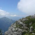
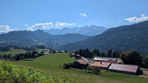
Nestled between the Glières plateau and the Bornes massif, stretching to the edge of Mont Lachat, Le Suet, despite its modest altitude, is a veritable natural balcony. From its summit, visitors can enjoy a vast panorama: the Lake Geneva basin, the slender silhouette of the Aravis mountains, and even some Savoyard peaks on the horizon.
The route, which is relatively uncrowded, consists of a steady climb through the dense Perrière forest. The trail climbs relentlessly before emerging onto a jumble of boulders that marks the edge of the woods. In autumn, progress can be more difficult due to fallen leaves covering the trail markers.
- Difficulty: Intermediate
- Altitude: 1,863 m
- Ascent: 2 hours 10 min
- Descent: 1 hour 30 min
- Elevation Gain: 820 meters
- Round-trip: 6.3 km
- Map: IGN 3430 ET
Getting There
Head to Saint-Jean-de-Sixt. In the village, follow the signs for ‘Forgeassoud-dessus’. Then park in the small car park on the left in front of a farm, just before the end of the road.
GPS Coordinates (WGS 84) of the Starting Point: 45.922959, 6.387914
Ascent
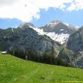
From the Forgeassoud-dessus car park, follow the small tarmac road. A sign indicating ‘Suet’ soon invites you to leave the asphalt for a path that leads into the forest on the right: this is where the real climb begins. The path climbs steadily, marked with signs, green and yellow arrows, and red markings painted on the rocks, guiding you step by step to the summit.
After about an hour of steady climbing, you reach the Cabane du Suet. A path leads to the end of Mont Lachat. Leave it on your left and continue through the forest, still following the red markings.
As you leave the woods, the landscape opens up and the grassy summit of Suet appears close by: you reach it after a few hairpin bends.
Descent
Descend via the same path.
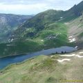
It is possible to descend via another route, which is less strenuous on the knees. This route passes through a place called Cerisset, as indicated on the map. From the Cabane du Suet, turn right onto a discreet track marked with red and white signs. Follow it to an altitude of 1,602 metres, then ignore the path on the right that climbs back up to Mont Lachat. The trail then descends in regular switchbacks. When you reach the hamlet of Cerisset, turn left, then left again at an altitude of 1,088 metres to return to the nearby car park.
Photos of Le Suet
")
")
")
")
")
")
")
")
")
")
")
")
")
")
")
")
")
")
")
")
")
")
")
")
")
")
")
")
")
")
")
")
")
")
")
")
Route
Download the route (KML) Download the route (GPX)
This post is also available in Français
About the Author
Pierre-Alexandre 33 ans, fondateur et webmaster de Randos-MontBlanc. Suivez-moi sur @pierrealexphotography