Sentier des Espagnols (Plateau des Glières)
During the Second World War, many Spanish Republicans who had fled the Franco dictatorship after the Spanish Civil War (1936-1939) took refuge in France. Many of them were then requisitioned by the French authorities to do manual labour or joined the Resistance maquis against the German occupation.
In the winter of 1944, a group of Spanish republicans were assigned to build a strategic road on the steep slope of the Pas du Roc, above the Borne valley. The purpose of the path was to transport weapons and supplies to the Glières maquis, particularly after the Allied parachute drops.
In their honour, the path was named the ‘Spanish Trail’, in recognition of their courage, their contribution to the French Resistance and their solidarity despite exile.
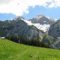
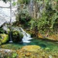
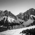
This hike combines nature, history and breathtaking panoramas, offering an enriching experience for lovers of mountains and heritage. From the Col des Glières, the trail crosses the Frêtes national forest and begins with a shady section. It then leads to the Champlaitier mountain pasture, a vast area with flowers depending on the season, ideal for a picnic break. The path then follows the Nant des Brassets to the lookout point at Pas du Roc, where the stream cascades down from the cliffs, forming an impressive waterfall depending on the time of year.
- Difficulty: Intermediate
- Altitude: 1,360 m at Champlaitier
- Total Time: 3 hours 30 min
- Elevation Gain: 530 meters
- Round-trip: 8.9 km
- Map: IGN 3430 OT
- Restrictions : Dogs allowed on a leash only
Getting There
Drive to Col des Glières carpark.
GPS Coordinates (WGS 84) of the Starting Point: 45.966341, 6.331319
Ascent
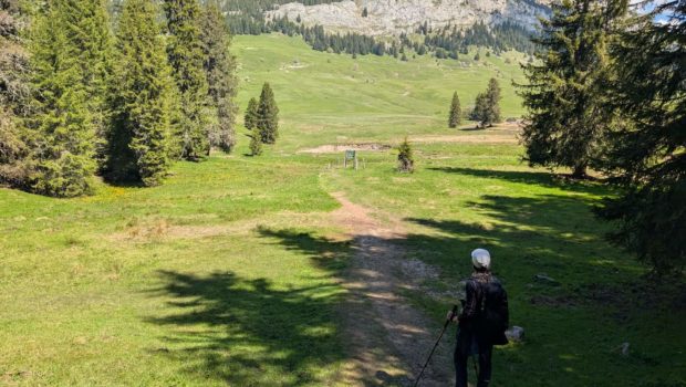
At the end of the car park, follow the signs for La Commanderie and Champlaitier. After a short, steep climb, you will reach the Commanderie. From here, the route descends to Champlaitier. Continue as far as the Ronceveau pass. After a few minutes, a sign indicates the Brassets footbridge, which you should cross. On the left, a faint path marks the start of the return journey.
After a fairly demanding descent along a rocky and sometimes steep path, you reach the Brassets footbridge giving access to Champlaitier. Continue on towards the Pas du Roc viewpoint. You enter the forest again, following the torrent, whose flow varies according to the season.
When you reach the sign for La Source, look for the unmarked path on the left: this is the way back. After a ten-minute walk, and after crossing an impressive boulder equipped with chains (very useful if the rock is wet), you will reach the lookout point at Pas du Roc.
Descent
Make a U-turn and return to the Source sign seen on the outward journey. Turn right and you will come to a large meadow alongside a stream – an ideal spot for a picnic. Continue in the same direction; the path is poorly marked at first, but you will soon reach a footbridge to cross. Follow the yellow arrows on the posts or the orange circles on the trees.
The path rises gently through the forest. After a short, very steep section, it becomes flat for a long distance, until you rejoin the path you took on the outward journey.
Photos of the Sentier des Espagnols (Plateau des Glières)
")
")
")
")
")
")
")
")
")
")
")
")
")
")
")
")
")
")
")
")
")
")
")
")
")
")
")
")
")
")
")
")
")
")
")
")
")
")
")
")
 (18 mai 2025)")
Route
Download the route (KML) Download the route (GPX)
This post is also available in Français
About the Author
Pierre-Alexandre 33 ans, fondateur et webmaster de Randos-MontBlanc. Suivez-moi sur @pierrealexphotography