Mont Clocher
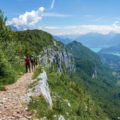
Mont Clocher is a summit of the Beaufortain Massif culminating at an altitude of 1976m. Located in the commune of Hauteluce, Mont Clocher is the object of a hike for the greatest number. Indeed, the route is devoid of difficulties and it offers a very wide panorama of the peaks of Savoie and Haute-Savoie.
The itinerary I propose here describes a circuit starting from the Col de la Lézette. This route takes a track going to Mont Clocher in a first moment before reaching the arrival of the Bellastat chairlift in a second moment. I have found it interesting to continue the route as we can observe an artificial lake as well as Mont Joly and Mont-Blanc Massif from the arrival of the chairlift. Then, the track goes down towards the chalets de Douce to finally take the track followed on the way up and reach the car park.
The origin of the toponym Mont Clocher comes from the fact that the summit is slender, pointed, and whose shape evokes a bell tower.
- Difficulty: Intermediate
- Altitude: 1,976 m
- Total Time: 4 hours 00 min
- Elevation Gain: 610 meters
- Round-trip: 11.5 km
- Map: IGN 3531 OT
Getting There
Go to Les Saisies and take the direction of the Col de la Lézette. Park in the car park located just after the chalet-restaurant.
GPS Coordinates (WGS 84) of the Starting Point: 45.760764, 6.552634
Itinerary
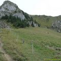
From the Col de la Lézette, take the track on the right towards the Col de la Légette. A little further on, the track splits in two. Leave the path on the right which goes down to advance on the left track. Continue for a few metres and finally turn left again on the path that goes into the forest.
If in doubt about the route to follow, simply refer to the red and yellow markings painted on the tree trunks. Continue on the path until you reach Plan Corbet where you will find the starting track. Then continue to Brichou and take the direction of Mont Clocher. The route to the top of Mont Clocher is revealed once you reach the signpost “Sous le Clocher”.
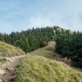
Then, the path rises more steeply to reach Mont Clocher quite easily.
Second part of the itinerary…
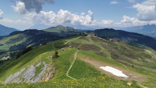
From the top, continue towards the arrival of the Bellastat chairlift visible in the distance. There are no more markings, so you have to rely on the signs of the ski slopes. The arrival of the chairlift gives the right to discover an artificial water reservoir and to admire a nice panorama on the surrounding peaks.
Then join the Plan des Fours chairlift by going up a few meters to reach a rather wide ridge path. Then, the path goes down, passes the chairlift, and turns left on an unmarked track which reaches the chalet de Douce. From there, you have to rely on the snow cannons to reach the track you can see at the bottom.
Once on the track, go back up and continue until you find the departure path at Plan Corbet.
Photos of Mont Clocher
")
")
")
")
")
")
")
")
")
")
")
 (31 mai 2020)")
")
")
")
")
")
")
")
")
")
")
")
")
")
")
")
")
")
")
")
")
")
")
")
")
")
Route
Download the route (KML) Download the route (GPX)
This post is also available in Français
About the Author
Pierre-Alexandre 33 ans, fondateur et webmaster de Randos-MontBlanc. Suivez-moi sur @pierrealexphotography