Hikes of the 3531OT IGN Map.
Browsing the "3531OT IGN Map" Tag
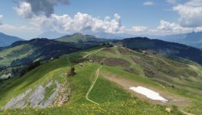
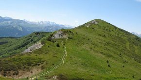
Mont Clocher
1 June 2020 | by Pierre-Alexandre
Mont Clocher is a summit of the Beaufortain Massif culminating at an altitude of 1976m. Located in the commune of Hauteluce, Mont Clocher is the object of a hike for the greatest number. Indeed, the route is devoid of difficulties and it offers a very wide panorama of the peaks of Savoie and Haute-Savoie
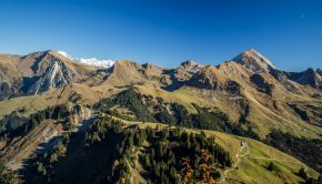
Montagne de Sulens
29 October 2016 | by Pierre-Alexandre
Located between Mont Charvin and Tournette, Montagne de Sulens offers a magnificent panorama on the Bauges Massif, as well as Aravis, Bornes, and Tarentaise. The hike doesn’t have any technical difficulties except the path that is sometimes hard to follow in its upper part
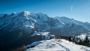
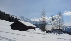
The Prarion
20 December 2015 | by Pierre-Alexandre
The Prarion, whose toponym evokes a “round meadow” or “ruined meadow,” is undoubtedly a beautiful winter hike. Located at the end of the Chamonix valley, this summit will enchant the hiker with the splendor of the panorama unveiled on Mont Blanc, Aiguilles Rouges, Fiz, and Aravis
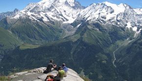
Mont Joly
15 August 2010 | by Pierre-Alexandre
Well visible from the Sallanches Valley, Mont Joly is a true observatory on the Mont Blanc Massif as well as the surrounding massifs, such as the Aravis Range or the Vanoise Massif. Like the peaks of the Italian Val Ferret
Petit and Grand Croisse Baulet
21 June 2009 | by Pierre-Alexandre
Visible from Sallanches, Croisse Baulet is a stroll of choice that will provide the hiker with one of the most beautiful views of Haute-Savoie as one can contemplate the Mont Blanc Massif, the Aravis Range, and the Fiz Massif
Bois d’Hermance and La Coule
31 March 2007 | by Pierre-Alexandre
The Bois d’Hermance, located on the heights of Megève, is the object of a beautiful winter hike. Intended for hikers who have already practiced snowshoeing, this itinerary of average difficulty leads under the slopes of Mont Joly after passing through a pretty coniferous forest
Randos les plus populaires


