Pointe d’Ardens and Lac de Tavaneuse
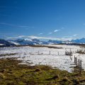
Located in the Abondance Valley, Pointe d’Ardens is the perfect excuse for a beautiful hike through lush green countryside. The route I suggest allows you to explore the valley south of Mont de Grange and reach Lake Tavaneuse via a detour from the Roc de Tavaneuse trail.
There are no particular difficulties: the path is well marked and signposted throughout.
- Difficulty: Intermediate
- Altitude: 1,959 m at the Pointe d’Ardens, 1,805 m at the Lac de Tavaneuse
- Ascent: 2 hours 20 min to get to the Pointe d’Ardens, 2 hours 50 min to get to the Lac de Tavaneuse
- Descent: 1 hour 35 min from the Lac de Tavaneuse
- Elevation Gain: 900 meters to get the Lac de Tavaneuse
- Round-trip: 13.0 km
- Map: IGN 3528 ET
Getting There
From Thonon-les-Bains, take the D902 then the D22 towards Vacheresse. Drive through the village, continue to Abondance then follow the road to Lac des Plagnes (small signs). At the end of the road, park in the large car park just after the chapel.
GPS Coordinates (WGS 84) of the Starting Point: 46.248780, 6.754325
Ascent
From the car park, take the track towards the Tinderets refuge. A few metres further on, turn right towards the ‘Refuge des Tinderets – 0 h 45’. After about ten minutes, you will reach a place called Cubourré: follow the signs towards the Tinderets refuge and the Chalets d’Ardens.
At a fork in the road, a sign indicates the direction of the Refuge des Tinderets on the left and the Chalets d’Ardens on the right. I suggest taking the left path: I prefer the rustic charm of a trail through grass still wet with morning dew to a boring road (which leads directly to the Chalets d’Ardens via a fairly steep slope). Continuing towards the Tinderets refuge, walk until you reach a fork where you will need to turn right towards ‘Sous Pointe de Chavache – 0 h 15’. The path is less marked but more pleasant as it is in the shade and crosses over to join the path you started on.
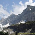
After a few fairly steep hairpin bends, the Chalets d’Ardens come into view around a bend. It’s a good place to take a break and admire the Mont de Grange and Pointe d’Ardens, which are clearly visible to the north. From there, continue towards the Pirons d’Ardens (0 h 35). A quick climb takes you to a valley that you have to cross before climbing again along a small path. The last part of the path to Pointe d’Ardens is not marked, so you need to look out for the path that descends to the right towards the peak, in a hairpin bend just before the small pass (the Pirons d’Ardens) towards Lac de Tavaneuse. This path, which is poorly marked for the first few metres, becomes very obvious and leads naturally to the summit of Ardens.
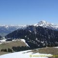
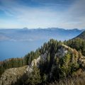
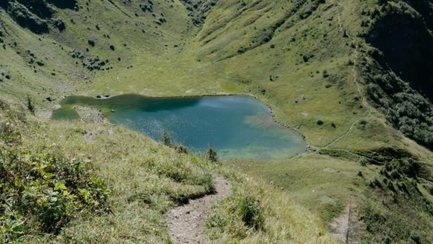
After admiring the superb panorama, turn back and retrace your steps to the main path. A short climb leads to the Pirons d’Ardens, offering a view of Lake Geneva and the Roc de Tavaneuse. Continue on and cross over to the Entre Deux Perthuis sub-pass, which overlooks the lake. Now switch to the other side and follow the small winding path to reach the lake shore in about fifteen minutes.
Descent
Turn back and retrace your steps to Cubourré. At the sign for Cubourré, take the small path on the left to reach the car park via Lac des Plagnes.
Photos of Pointe d’Ardens and the Lac de Tavaneuse
")
")
")
")
")
")
")
")
")
")
")
")
")
")
")
")
")
")
")
")
")
")
")
")
")
")
")
")
")
")
")
")
")
")
")
")
")
")
")
")
")
")
")
")
")
")
Route
Download the route (KML) Download the route (GPX)
This post is also available in Français
About the Author
Pierre-Alexandre 33 ans, fondateur et webmaster de Randos-MontBlanc. Suivez-moi sur @pierrealexphotography