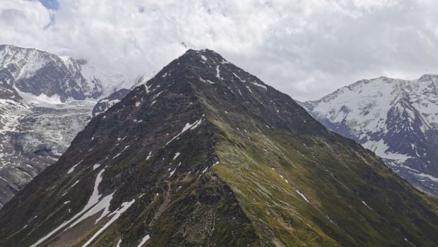
Mont Vorassay
Mount Vorassay (2287 m altitude) is a privileged observation point for a large number of prestigious and emblematic summits of Haute-Savoie. The circuit I propose below describes a loop in which the first part of the ascent is done in forest and undergrowth.
From the Passerelle du Glacier onwards, it should be noted that the terrain is completely open.
There is no particular difficulty to be noted on this route, especially as it is perfectly marked. However, this route is for well-trained walkers as it is over 14 km long.
- Difficulty: Hard
- Altitude: 2,287 m
- Total Time: 5 hours 30 min
- Elevation Gain: 1,230 meters
- Total Distance: 14.4 km
- Map: IGN 3531 ET
Getting There
From St-Gervais, reach the small village of Champel by a small, steep road.
GPS Coordinates (WGS 84) of the Starting Point: 45.86040, 6.73295
Ascent
From the car park, go to the village of Champel, 5 minutes away. At the sign “Le Champel”, follow the direction “Bionnassay, Col de Tricot” which leads to a wide forest track.
Continue to Chalère where you must turn right to leave the forest track. The climb then becomes much steeper in the forest until you reach a large rocky bar. The path then passes at the bottom of two beautiful waterfalls. Further on, the path comes up against the rocky bar mentioned above. You have to cross it with the help of metal steps and a very safe handrail.
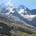
Then continue to join the path from Bionnassay and the Col de Voza. Then continue on a steeper terrain offering a view on the Glacier de Bionnassay and the Aiguille du Goûter. Further on, the Col de Tricot is in sight. Once you reach a small sign with no inscription, a modest path invites you to go directly to Mont Vorassay. The ascent is on a steep slope and then a ridge path before descending to the Col de Tricot. Rather than taking this route, I recommend continuing on the normal route to reach the Col de Tricot in about twenty minutes.
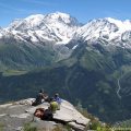
From the pass, take the right-hand path to go towards Mont Vorassay, which you reach in 20 minutes after a fairly steep climb. From the summit, the view is grandiose and makes for a well-deserved break.
Descent
Reach the Col de Tricot, then follow the rather steep path that descends from the Col de Tricot until you reach the chalets de Miage. This mountain hamlet offers a very nice atmosphere where the hiker has the possibility to eat at the Miage refuge with a view on the eponymous domes.
Before going to the Miage chalets, a sign indicates the path back to the Champel car park. It is a long traverse on the side of the mountain that follows the Gorges de la Gruvaz that can be heard rumbling below.
Then, continue to the Chalet du Tranchet where you must turn right to reach Champel and its car park.
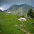
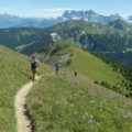
Photos of Mont Vorassay
")
")
")
")
")
")
")
")
")
")
")
")
")
")
")
")
")
")
")
")
")
")
Route
Download the route (KML) Download the route (GPX)
This post is also available in Français
About the Author
Pierre-Alexandre 33 ans, fondateur et webmaster de Randos-MontBlanc. Suivez-moi sur @pierrealexphotography