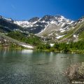
Lac Chécrouit and Lac des Vesses
Let’s have an excursion in Italy, on the route of the Tour du Mont Blanc, for a regular family walk that promises to be pleasant: the Lac Chécrouit and the Lac des Vesses.
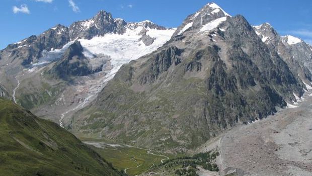
Located in the Val Veny delimited by the Col de la Seigne to reach the Tarentaise, these two lakes offer an unobstructed view of the southern slopes of the Mont-Blanc Massif and its many glaciers.
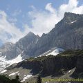
Easy and without any difficulty, the hike will undoubtedly intoxicate the hiker through the scene on the glaciers of Lex Blanche, Miage, and Brenva, as well as the imposing Aiguille Noire de Peuterey, Aiguille de la Brenva, and Aiguille de Tré-la-Tête that will surely give him the desire to conquer higher summits.
It is advisable to leave early in the morning, as parking is not easy and the number of spots is quite small.
- Difficulty: Easy
- Altitude: 2,165 m at the Lac Chécrouit, 2,330 m at the Lac des Vesses
- Ascent: 1 hour 30 min to get to the Lac Chécrouit, 2 hours 00 min to get to the Lac des Vesses
- Descent: 1 hour 30 min from the Lac des Vesses
- Elevation Gain: 750 meters
- Round-trip: 9.8 km
- Map: <b>IGC 107</b>
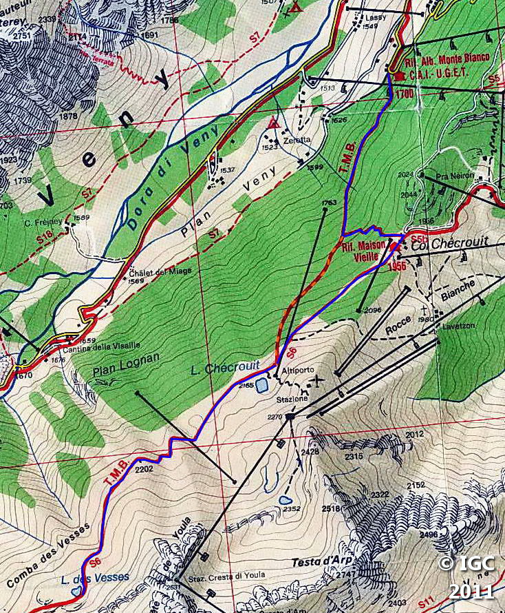
Getting There
At the exit of the Mont Blanc Tunnel, after about 800 m, turn left in the bend and follow the direction of Courmayeur – Val Veny. After passing under the expressway, drive more or less 700 m, and turn to the second right at the garage at the intersection “Val Veny.”
Follow the road that goes up, pass “Notre Dame de la Guérison” and, at a crossroads, turn left in the direction of “Pré de Pascal.”
Park in the first switchback next to the Refuge du Mont Blanc.
GPS Coordinates (WGS 84) of the Starting Point: 45.800448, 6.930943
Ascent
From the Refuge du Mont Blanc, take the abrupt pathway, which serves as a winter skiing trail, going to “Rifugio Maison Vieille” and “Lago Chécrouit.” This passage of very short duration constitutes the unique difficulty of the course.
After this steady climb, the elevation profile apparently flattens out up to the chairlift station where it is necessary to turn left to take the track marked with a yellow sign (number 6) and entering the forest.
A few switchbacks later, one gets to the Rifugio Maison Vieille at Col Chécrouit on a large plateau.
Go to the entrance of the refuge to follow the pathway marked with a sign indicating “Lago Chécrouit.”
The Lac Chécrouit is reached in about forty minutes after a very peaceful ascent.
To arrive at the Lac des Vesses, continue the relatively flat path along the Val Veny for about thirty minutes.
Descent
Take the same route as described above.
However, it is possible to cut along the ski slope, but the experience remains rather unpleasant for the knees. To do this, go back to the Lac Chécrouit and descend into the grassy track marked out by snow cannons and large signposts. The trail ends at the chairlift station left on the right in the morning.
Photos of the Lac Chécrouit and the Lac des Vesses


Route
Download the route (KML) Download the route (GPX)
This post is also available in Français
About the Author
Pierre-Alexandre 33 ans, fondateur et webmaster de Randos-MontBlanc. Suivez-moi sur @pierrealexphotography


