Lago d’Arpy
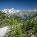
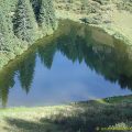
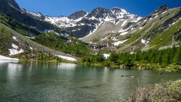
Lago d’Arpy is a lake of glacial origin located in the Vallon d’Arpy, near the eponymous col. Lago d’Arpy, surrounded by Mont Charvet, Becca Pugnenta and Mont Cormet, offers a spectacular view of the Grandes Jorasses, which, when the water is calm in the morning, is reflected in the clear waters of the lake. Very popular with the inhabitants of the Aosta Valley, Lago d’Arpy is a beautiful and unforgettable family hike that will delight young and old.
- Difficulty: Easy
- Altitude: 2,066 m
- Ascent: 1 hours 15 min
- Descent: 0 hour 50 min
- Elevation Gain: 220 meters
- Round-trip: 5.9 km
- Map: IGC n° 107 Monte-Bianco – Courmayeur
Getting There
Get to Courmayeur and continue to Morgex. At the first roundabout, turn right towards Col San Carlo. Follow the road to the pass and park in the parking lot just opposite the Hotel Genzianella.
GPS Coordinates (WGS 84) of the Starting Point: 45.742817, 6.989551
Ascent
The start of the itinerary is just in front of the Genzianella hotel. Take the wide path that leads into the forest. At the first crossing, leave on the right the direction “Colle della Croce” and continue on the left towards “Lago d’Arpy”. The road rises very slightly for about three kilometers to reach Lago d’Arpy. Continue on the left to follow a small path bypassing the lake from the north. A little further on, you cross a bridge overlooking the eastern shore of the lake. From there, the view is magnificent of the Grandes Jorasses.
Descent
Continue to reach the west shore of the lake. You’ll soon attain the trail taken for the ascent to get to the parking lot.
Photos of Lago d’Arpy
")
")
")
")
")
")
")
")
")
")
")
")
Route
Download the paper route (PDF) Download the route (KML) Download the route (GPX)
This post is also available in Français
About the Author
Pierre-Alexandre 33 ans, fondateur et webmaster de Randos-MontBlanc. Suivez-moi sur @pierrealexphotography