Col de Véry
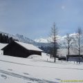
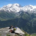
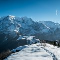
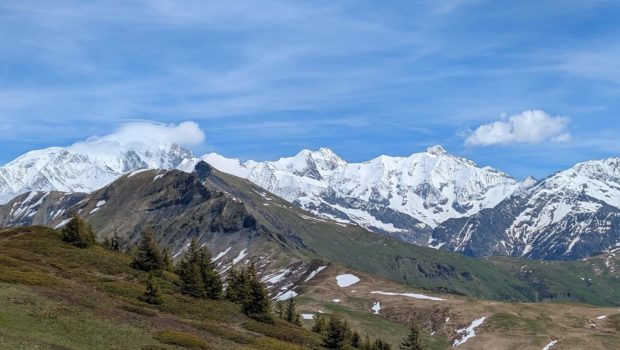
Situated between the Beaufortain and Val d’Arly regions, the hike to the Col de Véry offers a wonderful glimpse of the diversity of the Alpine landscape: forests, mountain pastures and sweeping views of Mont Blanc and the surrounding peaks. Accessible during the summer months, this varied circuit will appeal to you thanks to its unspoilt natural setting and spectacular views.
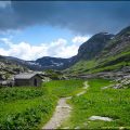
The route passes through contrasting landscapes, combining shady forest paths and open ridges. You’ll often come across grazing herds and the rich flora typical of high mountain pastures. Although not technically demanding, this hike does require a good level of fitness due to the elevation gain and the distance involved.
- Difficulty: Hard
- Altitude: 1,964 m
- Total Time: 5 hours 30 min
- Elevation Gain: 800 meters
- Total Distance: 16.0 km
- Map: IGN 3531 OT
Getting There
Go to the Leutaz car park in Megève
GPS Coordinates (WGS 84) of the Starting Point: 45.822922, 6.600281
Itinerary
From the end of the Leutaz car park, take the path towards ‘Sur les Prés’. You soon reach the Pont de Régo, which you should leave on the right (it will be used on the return journey), then continue straight on towards ‘Sur les Prés’. The slope becomes steeper until you reach a meadow, where a sign says ‘Pré Rosset’. Walk along the fence, then continue into the forest. The path then becomes steeper and steeper until you reach the sign for ‘Les Chambrettes’. After this tough climb, you reach ‘Sur les Prés’, where you can enjoy a magnificent panorama.
Continue on towards the Col de Véry, along a passable track as far as ‘Pré Rosset’, then cross several streams without difficulty. The path then leads to the Col de Véry. Then head towards Mont de Vorès: the slope becomes much gentler. After crossing the east and west peaks, the summit of Mont de Vorès is quickly reached.
From the summit, follow the signs for ‘Praz-sur-Arly’. A short descent leads to a flat area where you need to turn right (there are no signs here, only a yellow plaque – see photo 44). Alternatively, you can take a more direct but steeper route down the path behind the summit sign.
The descent continues as far as the Col de la Limace, where you should follow the signs for Praz-sur-Arly. Once you reach the Col de Basse Combe, head towards the Chalet de Chevan, then continue towards ‘Leutaz’ to rejoin the path you took on the outward journey, at the level of the Pont de Régo.
Photos of Col de Véry
")
")
")
")
")
")
")
")
")
")
")
")
")
")
")
")
")
")
")
")
")
")
")
")
")
")
")
")
")
")
")
")
")
")
")
")
")
")
")
")
")
")
")
")
")
")
")
")
Route
Download the route (KML) Download the route (GPX)
This post is also available in Français
About the Author
Pierre-Alexandre 33 ans, fondateur et webmaster de Randos-MontBlanc. Suivez-moi sur @pierrealexphotography