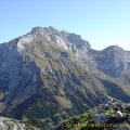
La Tournette
La Tournette is a superb spot to contemplate all the summits above Lake Annecy as well as the Aravis Range and the Mont Blanc Massif, sometimes hidden by the clouds when it’s hot. This ramble is somewhat technical in its final part, as many passages are equipped with cables and chains and, in places, the rock humid and therefore very slippery. I then advise the use of a cord for children.
There are many ibexes in the massif that you can easily approach and photograph. Be careful however as you reach the summit: these same ibexes can trigger rockfalls.
- Difficulty: Hard
- Altitude: 2,351 m
- Ascent: 3 hours 40 min (from Pré Ronds car park)
- Descent: 2 hours 20 min
- Elevation Gain: 1000 meters (from Col de l’Aulp)
- Round-trip: 7.8 km (from Col de l’Aulp)
- Map: IGN 3431 OT
Getting There
The Col de l’Aulp (1424 m) is apparently no longer accessible by car, so from now on you must park at the Prés Ronds car park (1216 m), before the village of Montmin, 25 km from Annecy in the direction of the Col de la Forclaz.
You must then continue on foot to the Col de l’Aulp along the dedicated footpath (about a 40 minute walk).
GPS Coordinates (WGS 84) of the Starting Point: 45.822714, 6.263126 (Pré Ronds car park)
Ascent
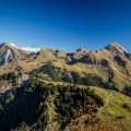
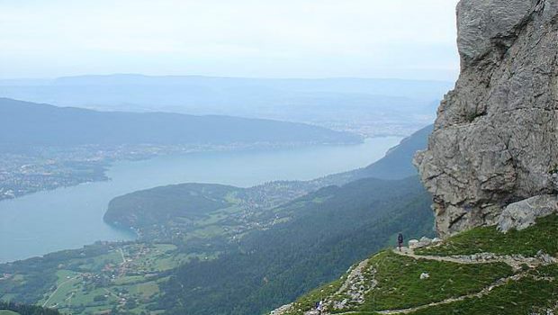
After the ascent from the Prés Ronds car park, the path goes to the right of the alpine chalet at the col de l’Aulp and already offers a beautiful view of the imposing Tournette that we are going to climb. The ascent is immediately quite steep until the Refuge de Blonay-Dufour (1,774 m) reached in about an hour. A variant of the usual route exists just before the refuge on the left, but I strongly discourage from using it, as many passages are akin to rock climbing. The landscape is already magnificent; you can observe Lake Annecy in its entirety as well as the snowy peaks of Savoie nearby. A little further on, you can stop at a waterfall to fill the flasks. After a walk in large blocks of rocks where you have to follow the painted arrows, take a very steep path that leads to a pass, denominated “Le Fauteuil,” at the foot of rocks that form the summit of La Tournette. The first cables and chains are no longer very far; By clutching well, these few passages are climbed without any problem whatsoever. You then arrive at the foot of a chimney equipped with two metal ladders that lead to the top of La Tournette.
Descent
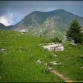
Take the same route as described above. Watch out for the descent, which in some places may seem more dangerous than during the ascent. In case of fog, do not hesitate to take your time to locate the trail; in case of doubt on the trail followed, a check on the IGN map is recommended. You can watch the milking of the cows in the alpine chalet of Col de l’Aulp and taste local specialities.
Photos of La Tournette


Route
Download the route (KML) Download the route (GPX)
This post is also available in Français
About the Author
Pierre-Alexandre 33 ans, fondateur et webmaster de Randos-MontBlanc. Suivez-moi sur @pierrealexphotography