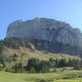
Montagne de Sous-Dine
Recognised by its steep cliffs on its northern face, Montagne de Sous-Dine is a choice hiking route in the heart of the Bornes massif.
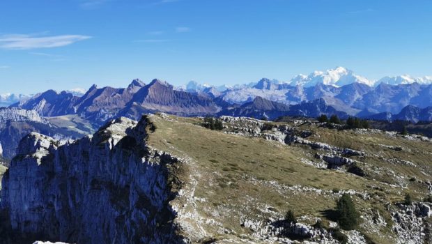
The ascent, which starts in the forest, continues through the lapiaz and ends on a vast grassy plateau which, due to its ideal location, offers an extensive panorama of numerous summits. From the Alps of Savoie and Haute-Savoie, through the Jura chain and the Swiss peaks, here is the context of this very beautiful walk.
There are no technical difficulties or tricky sections. However, youngsters will have to be careful when approaching the cliffs.
Note the possibility of doing the route as a loop via the Monthieu Passage. However, this passage with cable is steep. Moreover, it is permanently wet and very slippery due to its patinated rocks. Consequently, I strongly advise against this passage on the descent as it can quickly become dangerous.
- Difficulty: Intermediate
- Altitude: 2,004 m
- Ascent: 2 hours 20 min
- Descent: 1 hour 25 min
- Elevation Gain: 930 meters
- Round-trip: 11.5 km
- Map: IGN 3430 ET
Getting There
From La Roche sur Foron, take the direction of Thorens-Glières (D2 road). Go to the Col des Fleuries, and turn left towards Mont-Piton (C16 road). After about 2 km, turn right onto Les Cheneviers and park in the small car park at the end of the road.
GPS Coordinates (WGS 84) of the Starting Point: 46.014080, 6.301353
Ascent
From the car park, take the left-hand path marked “Sous-Dine – 3 h 00”. The track climbs through the forest and rises steeply. A few moments later, you will see the yellow arrows on a green background that you should follow along the route. When you reach a junction with the forest road, go straight on. The climb then becomes much steeper.
After about an hour’s walk from the car park, you come to a fork in the road with several signposts: follow the signs for “Sous-Dine par Trou de la Pierre – 2 h 00”. The progression is again steep. A little further on, turn right as indicated by the yellow arrow. The route then leaves the wide path to take a narrower trail that weaves its way through the trees.
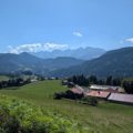
You will later reach the chalet de l’Artu with its magnificent view of the Parmelan. From here, follow the signs for “Sous-Dine – 1 hr 40 min”, inviting you to enter the forest again. At the next intersection, turn right as indicated by the yellow arrow. The path then progresses on an open road with the Parmelan on the right.
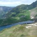
After a few hairpin bends, the path reaches the Trou de la Pierre. From here, turn left onto the well-marked path towards “Sous-Dine – 1 h 20”. After a climb through the undergrowth, you come to a small pass with a magnificent view of Mont Blanc. You must continue to follow the path with cairns that crosses the lapiaz to reach the summit after about thirty minutes.
Descent
Take the same route as depicted above.
Photos of the Montagne Sous-Dine
")
")
")
")
")
")
")
")
")
")
")
")
")
")
")
")
")
")
")
")
")
")
")
")
")
")
")
")
")
")
")
")
")
")
")
")
")
")
")
")
")
")
")
")
")
")
")
")
Route
Download the route (KML) Download the route (GPX)
This post is also available in Français
About the Author
Pierre-Alexandre 32 ans, fondateur et webmaster de Randos-MontBlanc. Suivez-moi sur @pierrealexphotography