Chaos du Chéran
The Chaos du Chéran walk starts at the Pont de l’Abîme, a remarkable structure built in 1885 by Ferdinand Arnodin which links the village of Cusy to that of Gruffy above the Chéran. With a span of almost 75 metres and overlooking the Chéran by 96 metres, the view is breathtaking and superb.
The itinerary forms a loop which allows you to walk along the Chéran as far as the Cusy footbridge and to return to the starting point on the other bank. Numerous explanatory and entertaining panels on the fauna and flora allow you to discover and understand the biotope of the area. The route, which is accessible to all, is very well marked out and the steepest or slippery parts are equipped with footbridges or wooden logs: there is therefore no danger.
However, it should be noted that the descent at the start of the trail is very steep and, as a result, the ascent to the other side at the end of the trail is a series of fairly steep log stairs that require a certain amount of effort. In addition, you have to be careful at the beginning of the route: after crossing the Pont de l’Abîme, you have to walk along the narrow road for about 300 metres to take the well-marked path on the left.
- Difficulty: Intermediate
- Altitude: 556 m
- Loop: 2 hours 15 min
- Elevation Gain: 350 meters
- Round-trip: 5.7 km
- Map: IGN 3431 OT
Getting There
Reach the Pont de l’Abîme car park, near Cusy, south-west of Annecy.
GPS Coordinates (WGS 84) of the Starting Point: 45.764444, 6.057667
Route Description (loop)
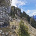
From the car park, reach and cross the Pont de l’Abîme. This bridge makes a lot of noise when cars pass over. However, there is no need to be afraid, the structure is solid. Continue along the small road for about 300 metres to reach the path on the left and follow the direction of the Passerelle de Cusy as indicated by the sign. A fairly steep descent leads to the bottom of the gorge and the banks of the Chéran. At the Cochet Nord sign, continue towards the Chaos du Chéran: the path is a little steeper, but equipped with wooden footbridges that make the progression quite easy.
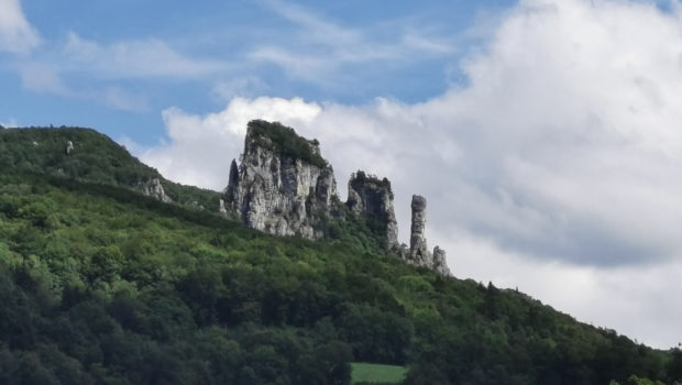
The Chaos du Chéran offers a view of the gorges and the pont de l’Abîme. From there, turn back to the previous signpost and walk towards the Passerelle de Cusy. Follow the well-marked path along the Chéran, punctuated by explanatory signs, until you reach the Passerelle de Cusy. Cross the Chéran and go to the Cabane des Pêcheurs. Then, head towards the Pont de l’Abîme.
The path then moves away from the Chéran and starts to go up before going back down to its banks. Continue until you reach a fairly steep slope. Then, after a flat area, a steep series of log stairs makes it easier to climb back to the starting point. I advise people who are not used to walking to take it easy.
Photos of Chaos du Chéran
")
")
")
")
")
")
")
")
")
")
")
")
")
")
")
")
")
")
")
")
")
")
")
")
")
Route
Download the route (KML) Download the route (GPX)
This post is also available in Français
About the Author
Pierre-Alexandre 33 ans, fondateur et webmaster de Randos-MontBlanc. Suivez-moi sur @pierrealexphotography