Croix de Fer
The hike to the Croix de Fer from the Col des Aravis is an easy and very pleasant walk. It is the perfect route when you want to stretch your legs without tackling a steep climb.
The walk starts directly from the pass, taking a track that gently winds away from the chalets. The climb is gradual and easy, and you can see the cross quite early on, which is great motivation for the whole walk!
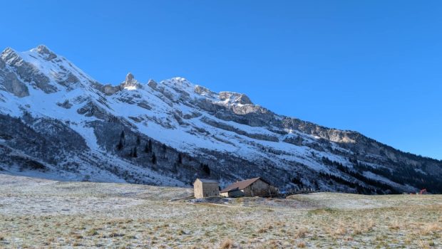
The path continues along a balcony and the view gradually opens up onto the magnificent Aravis mountain range. Once you reach the cross, the view is even more beautiful: the Croise Baulet stands opposite, offering an exceptional panorama for such a short outing.
This is a very accessible hike, ideal for summer or winter snowshoeing.
- Difficulty: Easy
- Altitude: 1,648 m
- Total Time: 1 hour 15 min
- Elevation Gain: 160 meters
- Round-trip: 4.00 km
- Map: IGN 3531 OT
Getting There
Go to the Col des Aravis car park.
GPS Coordinates (WGS 84) of the Starting Point: 45.871608, 6.464238
Route
From the pass car park, follow the track that starts just behind the chalets. At the first sign for “La Zorette”, continue straight on towards “La Croix de Fer” (the “Source des Aravis” path on the right is the one you will take on the way back). Very soon, when the road veers to the right, you will reach a small viewpoint equipped with an orientation table. Continue to the sign for “La Tête” and turn right, still heading towards the cross. Continue to the next sign for “Croix de Fer” and follow the sign on the left towards the “Point de vue” (viewpoint). The cross is about 200 metres further on.
To return, do not retrace your steps: take the faint path that starts behind the cross. It will lead you to the path that joins the Planchaux chalets. Once at the sign, follow the direction “Source des Aravis”. All you have to do is continue to the spring itself, then follow the path that veers to the right until you reach the car park where you started.
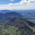
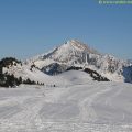
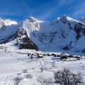
Photos of Croix de Fer


Route
Download the route (KML) Download the route (GPX)
This post is also available in Français
About the Author
Pierre-Alexandre 33 ans, fondateur et webmaster de Randos-MontBlanc. Suivez-moi sur @pierrealexphotography