Trient Glacier
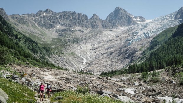
I propose an excursion in Switzerland for an easy walk that allows observing the Trient Glacier.
The trail follows along the Bisse du Trient for about four kilometers. A “bisse” is an artificial canal built on the slope of a mountain to bring water from the glacier and thus irrigate the crops.
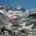
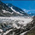
Contrary to the first version of the description published in 2004, it is no longer possible to reach the bottom of the glacier since it has retreated considerably. From now on, to contemplate the glacier in its entirety, that is from Petite Pointe d’Orny to the valley, one has to take the Sentier de la Lys indicated by red marks once arrived at Chalet du Trient and going to Vésevey (my description stops there) and Fenêtre d’Arpette.
You will find at the bottom of the page comparative photos showing the evolution of the glacier since 1985.
- Difficulty: Intermediate
- Altitude: 1,583 m at the chalet / 2,096 m at Vésevey
- Ascent: 0 hour 50 min to get to the chalet / 2 hours 30 min to get to Vésevey
- Descent: 2 hours 00 min from Vésevey
- Elevation Gain: 20 meters to get to the chalet / 560 m to get to Vésevey
- Round-trip: 11.0 km
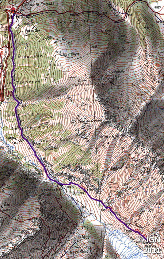
- Map: <b>IGN 3630 OT</b>
Getting There
The departure is at the Col de la Forclaz car park. After Chamonix, take the direction of Argentière and then Vallorcine. Pass the customs to enter Switzerland, and follow the Col de la Forclaz.
GPS Coordinates (WGS 84) of the Starting Point: 46.057694, 7.001375
Ascent
The departure is to the right of the parking lot of the Forclaz. The trail leads very quickly into the forest and allows admiring all along the route the village of Trient below, the névé descending from the slopes around, and the bisse that will lead to the chalet. This trail is flat to the chalet reached in about fifty minutes. There’s no difficulty to point out, except just in places the heights close to the track over very short distances; however, people with a fear of heights won’t have any problem whatsoever as the path is very wide and well maintained.
From the chalet, follow the red marks and the signs indicating “Fenêtre d’Arpette. ” At a crossroads, follow the signposts and turn left onto a path that describes short steep switchbacks.
Once arrived in the wood, the pathway slightly flattens out and skirts the glacier. Continue and stop to Vesevey, where one can find some ruins.
Descent
Take the same route as described above.
On the return journey towards Chamonix, I suggest a stop at the Chalet of Aiguilles Rouges National Nature Reserve where it is possible to contemplate pictures of the Trient Glacier and many specimens of the fauna and flora of the region.
Photos of Trient Glacier
")
")
")
")
")
")
")
")
")
")
")
")
")
")
")
")
")
")
")
")
")
")
")
")
")
")
")
")
")
")
")
")
")
")
")
")
")
")
")
Evolution of the Glacier over time
")
")
")
")
")
")
")
")
")

Route
Download the route (KML) Download the route (GPX)
This post is also available in Français
About the Author
Pierre-Alexandre 33 ans, fondateur et webmaster de Randos-MontBlanc. Suivez-moi sur @pierrealexphotography


