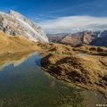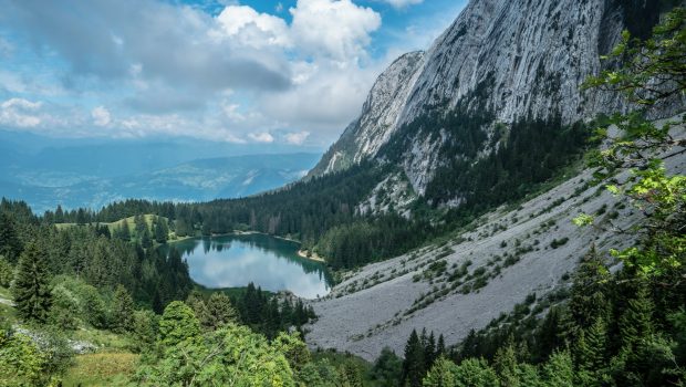
Lac Bénit
Located at the foot of the majestic Bargy Massif, the Lac Bénit is a haven of tranquility. Family walk par excellence, the itinerary is within reach of all since that the very short path remains devoid of difficulties and technical passages. Two paths are available to the walker: the Morsulaz trail, which is the most “arduous,” due to an average slope of 27% over 1.6 km; The Bété trail is slightly longer but offers a lower elevation gain with an average slope of 16% over 2.2 km. In order to make the route less monotonous, I also propose to make a loop by descending by one of the two suggested variants (ascent by the Bété / descending by Morsulaz and vice versa); Once you arrive at one of the parking lots (either at Morsulaz or the Bété), you have to take the asphalt road for about 1.5 km to reach the starting point.
- Difficulty: Easy
- Altitude: 1,452 m
- Ascent: 1 hour 15 min via Morsulaz / 0 hour 50 min via the Bété
- Descent: 0 hour 35 min to Morsulaz / 0 hour 30 min to the Bété
- Elevation Gain: 460 meters via Morsulaz / 340 meters via the Bété
- Round-trip: 5.0 km via Morsulaz and the Bété / 6.8 km for the loop
- Map: IGN 3430 ET
Getting There
After Bonneville, go towards Cluses, then turn right to reach Mont Saxonnex. In the village, follow again on the left until Morsulaz where you will park near the chairlift. For those wishing to start from Bété, the car park is about 1 km before Morsulaz (very tight turn on the left indicated by the sign “Lac Bénit par Malacquis”).
GPS Coordinates (WGS 84) of the Starting Point: 46.028675, 6.487376 (Morsulaz) / 46.041394, 6.487516 (Le Bété)
Ascent (via Morsulaz)
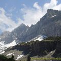
The trail begins to the right of the start of the chairlift of Morsulaz towards the small wood. The climb is quite steep until the chairlift arrival station, where you can see the Lac Bénit surrounded by pine trees. Follow the footpath that runs down the lake from the left to the junction of the path that comes from the Bété. The Lac Bénit is now a few steps away; One can admire the impressive Bargy Massif with the scree that marks the beginning of the very perilous track that leads to the Col del l’Encrenaz then to the top of the Bargy (2,300 m). With a little luck, you can perhaps glimpse a vulture or an ibex.
Ascent (via the Bété)
From the car park of the Bété, take the well-traced path going into the forest. After several laces, the pathway leads to the Chalets de la Pierrière then Malacquis on the ski slope marked by the ski lift. In a few minutes, you reach the lake located just below the arrival station of the ski lift.
Descent
Either descend by the same route or descend by the variant (Morsulaz or the Bété). If you descend by the variant, you then have to take the asphalt road for about 1.5 km to reach the starting point.
Photos of the Lac Bénit
")
")
")
")
")
")
")
")
")
")
")
")
")
")
")
")
")
")
")
")
")
")
")
")
")
")
")
")
")
")
")
")
")
")
")
")
")
")
")
")
")
")
")
")
")
")
Route
Download the route (KML) Download the route (GPX)
This post is also available in Français
About the Author
Pierre-Alexandre 30 ans, fondateur et webmaster de Randos-MontBlanc. Suivez-moi sur @pierrealexphotography