Grand Col Ferret and Tête de Ferret
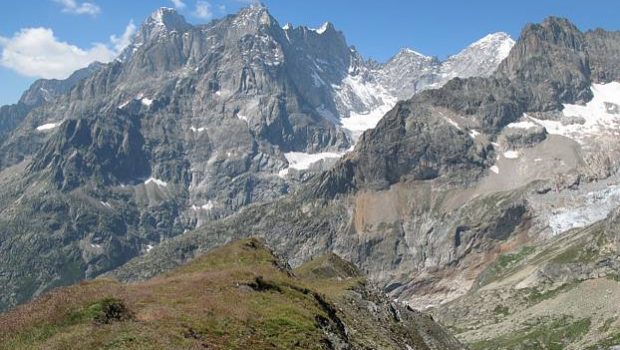
Very appreciated by the hikers around Mont Blanc, the Val Ferret impresses by the incredible view on the Italian side of the Mont Blanc Massif.
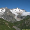
Tête de Ferret, located at the end of the Val Ferret, symbolizes the border between Switzerland and the Aosta Valley in Italy.
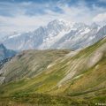
Like all the summits of the Val Ferret, the panorama offered remains unforgettable, but the Grand Col and Tête de Ferret allow to widen the field of vision and to observe the Swiss mountains such as Grand Combin, Mont Vélan, as well as the Valley of Fouly.
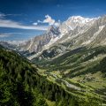
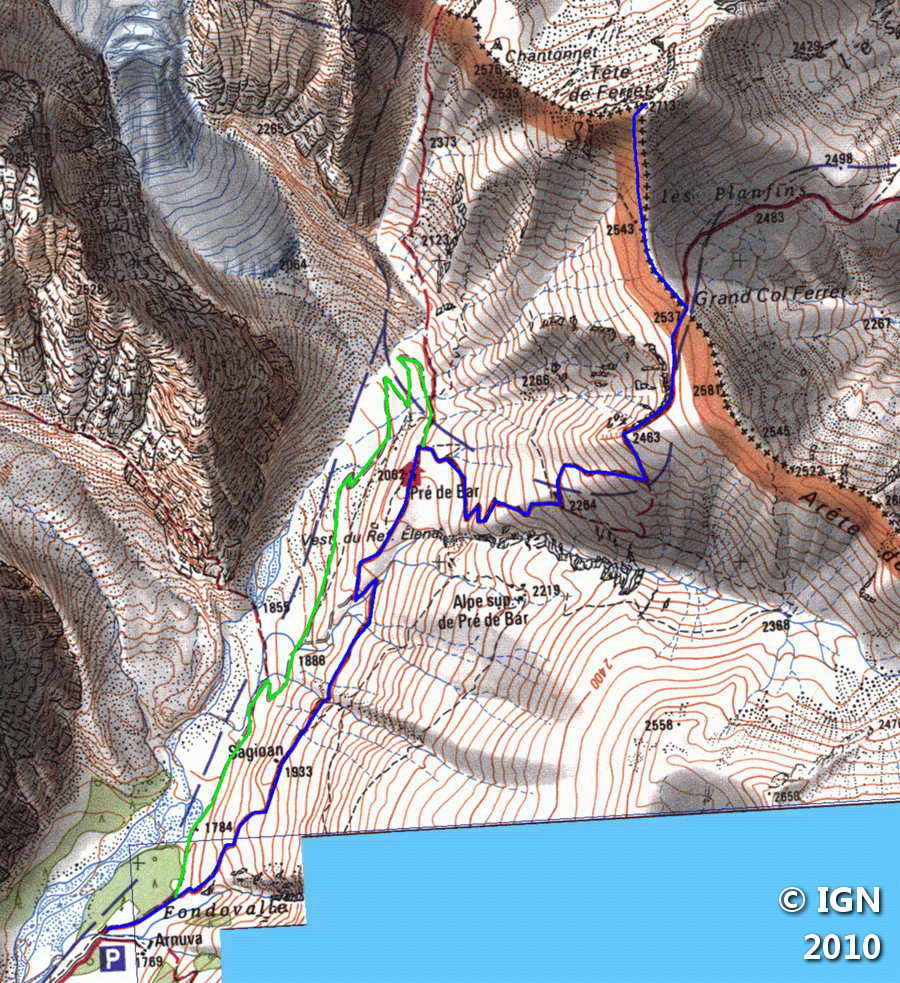
Without difficulty, the itinerary first reaches the Elena Refuge perched in front of the Glacier de Pré de Bar, then rises more frankly towards the Grand Col Ferret in the Alp de Pré de Bar, under the Arête des Éconduits. The last ascent to the peak is, however, steeper, but the outlook at the top will fulfill exhausted hikers.
- Difficulty: Intermediate
- Altitude: 2,713 m at Tête de Ferret
- Ascent: 2 hours 30 min
- Descent: 1 hour 40 min
- Elevation Gain: 990 meters
- Round-trip: 9.8 km
- Map: IGN 3630 OT
Getting There
At the end of the Mont Blanc Tunnel on the Italian side, turn left at the first switchback in the direction of Val Ferret.
Follow the road on a dozen kilometers to reach the hamlet of Arnuva and its refuge on the right. Pass the small bridge and continue on the road for about 400 meters to park in a little parking lot in the forest where start many routes marked with yellow signs.
Please note that parking in the Italian Val Ferret is subject to a charge and limited to 260 spaces. Access is controlled by automatic barriers. Access by car to Planpincieux is not possible if the maximum number of cars has been reached. It is therefore important to leave very early in the morning to avoid any unpleasant surprises!
It is strongly recommended that you park your car in Courmayeur and take the free shuttle bus (green line) that runs the entire length of Val Ferret: https://aosta.arriva.it/courmayeur-mont-blanc/
GPS Coordinates (WGS 84) of the Starting Point: 45.872465, 7.054806
Ascent
From the small car park of the Arnuva, take the trail in the direction of the Grand Col Ferret which climbs the mountain pasture.
Not very steep and straight enough, this pathway wins in fifty minutes the Elena Refuge.
From the refuge, continue on the road that goes to the right and rising more frankly up to a trough after some switchbacks.
Follow the signs marked “TMB” in yellow, and proceed until you see the Grand Col Ferret.
The path becomes flatter and slowly arrives at the Grand Col Ferret where you will find a viewpoint indicator as well as a border marker.
From the Grand Col Ferret, take the pathway that goes left towards Tête de Ferret. After a short descent, you reach a second boundary marker symbolizing the beginning of the ascent to the peak.
The well-marked trail ascends very steeply up the slope; The summit is won in about twenty minutes.
Descent
Take the same path as described above. At the signposts at the Elena Refuge, take the road that leads to the left and runs along the Torrent du Glacier Pré-de-Bar, gently reaching the car park of the Arnuva.
Photos of Grand Col Ferret and Tête de Ferret


Route
Download the route (KML) Download the route (GPX)
This post is also available in Français
About the Author
Pierre-Alexandre 30 ans, fondateur et webmaster de Randos-MontBlanc. Suivez-moi sur @pierrealexphotography


