Le Môle
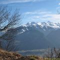
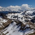
Le Môle is one of the greatest classics of the region that allows discovering a 360 ° panorama on all the surrounding massifs, notably the nearby Bornes, but also the Giffre and the Chablais Massif. If you’re too tired to climb the mountain, the Petit Mole constitutes a great spot to observe the encircling peaks. As a point of interest, it was from the summit of Le Môle in 1775 that the Englishman Schuckburgh evaluated the height of the Mont Blanc to 4,804 m (not far from the actual altitude of 4,810 m).
- Difficulty: Easy
- Altitude: 1,863 m
- Ascent: 2 hours 00 min
- Descent: 1 hour 40 min
- Elevation Gain: 800 meters
- Round-trip: 9.2 km
- Map: IGN 3429 ET
Getting There
Go to Viuz-en-Sallaz then go to St-Jean de Tholomé. Continue in the direction of Bovère and cross the hamlets of Chez Baron, Vers Chateau, Chez Folliex, until the end of the road at the bar of Chez Béroud.
GPS Coordinates (WGS 84) of the Starting Point : 46.099143, 6.438364
Ascent
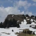
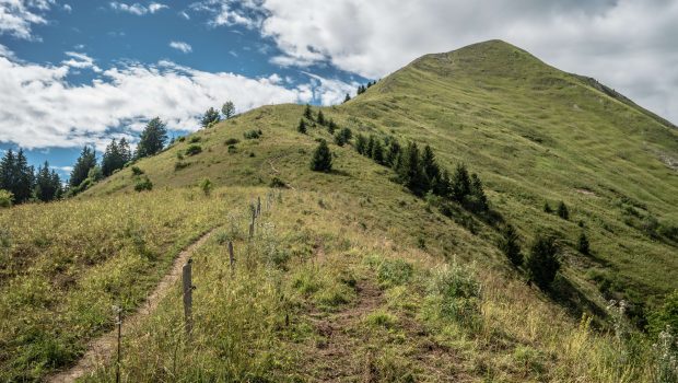
From the car park, take the path into the forest. The latter rises more or less gently and leads in about thirty minutes at the Petit Môle. From here you have a magnificent view of all the surrounding peaks. Continue the well-traced trail in the slope that rises gently at the beginning, but quickly becomes steeper towards the summit of Le Môle materialized by a cross. The panorama of the Chablais, the Mont-Blanc and the Bornes Massif is simply magnificent. Be careful not to let yourself be overcome by the altitude, as the north slope is very abrupt. Note that the true summit of Le Môle is located at the IGN stone marker (left path at the sign just before the cross).
Descent
You can descend by the same route or descend by the trail along the ridge in order to make a loop (path in green below this paragraph). You’ll go through some undergrowth before getting back to the buvette at Petit Mole. The ridge path is quite steep and slippery in places; Do not hesitate to stay in the grass to benefit from a little more grip in the slope.
Photos of Le Môle
")
")
")
")
")
")
")
")
")
")
")
")
")
")
")
")
")
")
")
")
")
")
")
")
")
")
")
")
")
")
 étaient bien pris ce jour-là (21 avril 2007)")
")
")
")
")
")
")
")
Route
Download the route (KML) Download the route (GPX)
This post is also available in Français
About the Author
Pierre-Alexandre 30 ans, fondateur et webmaster de Randos-MontBlanc. Suivez-moi sur @pierrealexphotography